Kemin geodata
Kemin (Chüy) is a seat of a second-order administrative division; located in Kyrgyzstan in Asia/Bishkek (GMT+6) time zone. With population of 10,295 people, there are 29 cities with bigger population in this country. Compared to other cities in Kyrgyzstan, 88.1% of cities are located further ↓South; 85.7% of cities are located further ←West and 50% of cities have lower elevation than Kemin. Note1


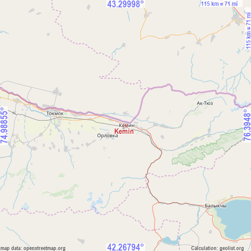
Kemin GPS coordinates[2]
42° 47' 9.996" North, 75° 41' 30.012" East
| Map corner | latitude | longitude |
|---|---|---|
| Upper-left | 43.29998°, | 74.98855° |
| Center: | 42.78611°, | 75.69167° |
| Lower-right: | 42.26794°, | 76.3948° |
| Map W x H: | 114.8×114.8 km | = 71.3×71.3mi |
| max Lat: | 42.89106° ⇑11.9% North |
| Kemin: | 42.78611° |
| min Lat: | ⇓88.1% South 39.55274° |
| min Long | Kemin | max Long |
| 69.3716° | 75.69167° | 78.52702° |
| W 85.7%⇐ | ⇒14.3% E |
Elevation
Elevation of Kemin is 1123 m = 3684 ft, and this is 78.4 m = 257 ft below average elevation for this country.
| Max E: |
2638 m = 8655 ft | 50% |
| Avg. | 1201.4 m = 3942 ft | |
| Kemin | 1123 m = 3684 ft | |
Min E: |
504 m = 1654 ft | 50% |
See also: Kyrgyzstan elevation on elevation.city.
Geographical zone
Kemin is located in North temperate zone (between Tropic of Cancer and the Arctic Circle). Distance of this Northern Tropic circle is 2151.5 km =1336.9 mi to South.| Distance of | km | miles | from Kemin |
|---|---|---|---|
| North Pole | 5249.7 | 3262 | to North |
| Arctic Circle | 2643.8 | 1642.8 | to North |
| Tropic Cancer | 2151.5 | 1336.9 | to South |
| Equator | 4757.4 | 2956.1 | to South |


Nearby cities:
15 places around Kemin: (largest is in red/bold)
• Balykchy
54.4 km =33.8 mi,  131°
131°
• Belovodskoye
129.2 km =80.3 mi,  272°
272°
• Bishkek
90.3 km =56.1 mi,  275°
275°
• Bokombayevskoye
130.1 km =80.8 mi,  124°
124°
• Chayek
135.7 km =84.3 mi,  225°
225°
• Cholpon-Ata
114.6 km =71.2 mi,  97°
97°
• Chuy
33.6 km =20.9 mi, 276°
• Ivanovka
50.7 km =31.5 mi, 282°
• Kadzhi-Say
141.5 km =87.9 mi, 120°
• Kant
69.5 km =43.2 mi, 279°
• Kochkor
63.7 km =39.6 mi,  175°
175°
• Lebedinovka
83.4 km =51.8 mi, 277°
• Sokuluk
113.5 km =70.5 mi, 273°
• Sosnovka
147.6 km =91.7 mi,  263°
263°
• Tokmok
32.4 km =20.1 mi, 281°
Sources, notices
• [Note1] Compared only with cities in Kyrgyzstan existing in our database
• [Src1] Map data: © OpenStreetMap contributors (CC-BY-SA)
• [Src2] Other city data from geonames.org with taken over terms of usage.
• [Src3] Geographical zone / Annual Mean Temperature by Robert A. Rohde @ Wikipedia
