Zaysan geodata
Zaysan (East Kazakhstan) is a populated place; located in Kazakhstan in Asia/Almaty (GMT+5) time zone. With population of 17,600 people, there are 73 cities with bigger population in this country. Compared to other cities in Kazakhstan, 59.3% of cities are located further ↑North; 100% of cities are located further ←West and 85.2% of cities have lower elevation than Zaysan. Note1


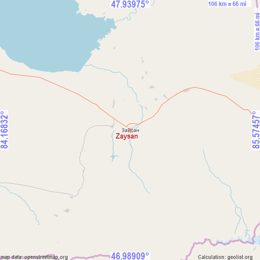
Zaysan GPS coordinates[2]
47° 27' 59.652" North, 84° 52' 17.184" East
| Map corner | latitude | longitude |
|---|---|---|
| Upper-left | 47.93975°, | 84.16832° |
| Center: | 47.46657°, | 84.87144° |
| Lower-right: | 46.98909°, | 85.57457° |
| Map W x H: | 105.7×105.7 km | = 65.7×65.7mi |
| max Lat: | 54.90596° ⇑59.3% North |
| Zaysan: | 47.46657° |
| min Lat: | ⇓40.7% South 40.66338° |
| min Long | Zaysan | max Long |
| 46.83361° | 84.87144° | 84.87144° |
| W 100%⇐ | ⇒0% E |
Elevation
Elevation of Zaysan is 635 m = 2083 ft, and this is 278.5 m = 914 ft above average elevation for this country.
| Max E: |
1847 m = 6060 ft | 14.8% |
| Zaysan | 635 m 2083 ft | |
| Avg. | 356.5 m = 1170 ft | |
Min E: |
-26 m = -85 ft | 85.2% |
See also: Kazakhstan elevation on elevation.city.
Geographical zone
Zaysan is located in North temperate zone (between Tropic of Cancer and the Arctic Circle). Distance of this North polar circle is 2123.4 km =1319.4 mi to North.| Distance of | km | miles | from Zaysan |
|---|---|---|---|
| North Pole | 4729.3 | 2938.6 | to North |
| Arctic Circle | 2123.4 | 1319.4 | to North |
| Tropic Cancer | 2671.9 | 1660.2 | to South |
| Equator | 5277.8 | 3279.5 | to South |


Nearby cities:
15 places around Zaysan: (largest is in red/bold)
• Aksuat
164 km =101.9 mi,  327°
327°
• Asūbulaq
267.8 km =166.4 mi, 330°
• Belogorskīy
257.1 km =159.8 mi, 330°
• Druzhba
306.9 km =190.7 mi,  216°
216°
• Georgīevka
319.4 km =198.5 mi,  310°
310°
• Kokpekty
232.4 km =144.4 mi, 307°
• Kurchum
151.8 km =94.3 mi,  323°
323°
• Maleyevsk
264.5 km =164.4 mi,  350°
350°
• Ognevka
281.7 km =175 mi, 331°
• Pervorosiyskiy
261.2 km =162.3 mi,  343°
343°
• Priisk Boko
297.3 km =184.7 mi, 306°
• Tūghyl
57.6 km =35.8 mi,  299°
299°
• Urzhar
248 km =154.1 mi,  260°
260°
• Zhanga Buqtyrma
260.1 km =161.6 mi, 337°
• Zyryanovsk
255.1 km =158.5 mi, 350°
Sources, notices
• [Note1] Compared only with cities in Kazakhstan existing in our database
• [Src1] Map data: © OpenStreetMap contributors (CC-BY-SA)
• [Src2] Other city data from geonames.org with taken over terms of usage.
• [Src3] Geographical zone / Annual Mean Temperature by Robert A. Rohde @ Wikipedia
