Zyryanovsk geodata
Zyryanovsk (East Kazakhstan) is a populated place; located in Kazakhstan in Asia/Almaty (GMT+5) time zone. With population of 44,929 people, there are 31 cities with bigger population in this country. Compared to other cities in Kazakhstan, 61.9% of cities are located further ↓South; 99.3% of cities are located further ←West and 70% of cities have lower elevation than Zyryanovsk. Note1


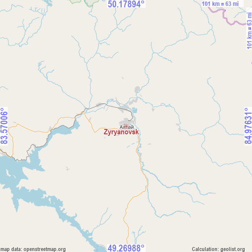
Zyryanovsk GPS coordinates[2]
49° 43' 35.544" North, 84° 16' 23.448" East
| Map corner | latitude | longitude |
|---|---|---|
| Upper-left | 50.17894°, | 83.57006° |
| Center: | 49.72654°, | 84.27318° |
| Lower-right: | 49.26988°, | 84.97631° |
| Map W x H: | 101.1×101.1 km | = 62.8×62.8mi |
| max Lat: | 54.90596° ⇑38.1% North |
| Zyryanovsk: | 49.72654° |
| min Lat: | ⇓61.9% South 40.66338° |
| min Long | Zyryanovsk | max Long |
| 46.83361° | 84.27318° | 84.87144° |
| W 99.3%⇐ | ⇒0.7% E |
Elevation
Elevation of Zyryanovsk is 471 m = 1545 ft, and this is 114.5 m = 376 ft above average elevation for this country.
| Max E: |
1847 m = 6060 ft | 30% |
| Zyryanovsk | 471 m 1545 ft | |
| Avg. | 356.5 m = 1170 ft | |
Min E: |
-26 m = -85 ft | 70% |
See also: Zyryanovsk elevation on elevation.city.
Geographical zone
Zyryanovsk is located in North temperate zone (between Tropic of Cancer and the Arctic Circle). Distance of this North polar circle is 1872.1 km =1163.3 mi to North.| Distance of | km | miles | from Zyryanovsk |
|---|---|---|---|
| North Pole | 4478 | 2782.5 | to North |
| Arctic Circle | 1872.1 | 1163.3 | to North |
| Tropic Cancer | 2923.2 | 1816.4 | to South |
| Equator | 5529.1 | 3435.6 | to South |


Nearby cities:
15 places around Zyryanovsk: (largest is in red/bold)
• Aksuat
119.8 km =74.4 mi,  200°
200°
• Altayskiy
148.3 km =92.1 mi,  292°
292°
• Asūbulaq
89.1 km =55.4 mi,  257°
257°
• Auezov
193.6 km =120.3 mi,  269°
269°
• Belogorskīy
85.7 km =53.3 mi,  251°
251°
• Belousovka
133 km =82.6 mi, 289°
• Glubokoye
147.7 km =91.8 mi, 288°
• Kokpekty
174 km =108.1 mi,  231°
231°
• Kurchum
136.5 km =84.8 mi, 199°
• Maleyevsk
9.9 km =6.2 mi,  7°
7°
• Ognevka
90.5 km =56.2 mi, 266°
• Pervorosiyskiy
30.5 km =19 mi, 267°
• Ridder
87.5 km =54.4 mi,  321°
321°
• Ust-Kamenogorsk
122.6 km =76.2 mi,  282°
282°
• Zhanga Buqtyrma
54.9 km =34.1 mi, 258°
Sources, notices
• [Note1] Compared only with cities in Kazakhstan existing in our database
• [Src1] Map data: © OpenStreetMap contributors (CC-BY-SA)
• [Src2] Other city data from geonames.org with taken over terms of usage.
• [Src3] Geographical zone / Annual Mean Temperature by Robert A. Rohde @ Wikipedia
