Maleyevsk geodata
Maleyevsk (East Kazakhstan) is a populated place; located in Kazakhstan in Asia/Almaty (GMT+5) time zone. With population of 2,678 people, there are 232 cities with bigger population in this country. Compared to other cities in Kazakhstan, 63.7% of cities are located further ↓South; 99.6% of cities are located further ←West and 66.7% of cities have lower elevation than Maleyevsk. Note1


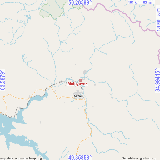
Maleyevsk GPS coordinates[2]
49° 48' 51.876" North, 84° 17' 27.672" East
| Map corner | latitude | longitude |
|---|---|---|
| Upper-left | 50.26599°, | 83.5879° |
| Center: | 49.81441°, | 84.29102° |
| Lower-right: | 49.35858°, | 84.99415° |
| Map W x H: | 100.9×100.9 km | = 62.7×62.7mi |
| max Lat: | 54.90596° ⇑36.3% North |
| Maleyevsk: | 49.81441° |
| min Lat: | ⇓63.7% South 40.66338° |
| min Long | Maleyevsk | max Long |
| 46.83361° | 84.29102° | 84.87144° |
| W 99.6%⇐ | ⇒0.40000000000001% E |
Elevation
Elevation of Maleyevsk is 433 m = 1421 ft, and this is 76.5 m = 251 ft above average elevation for this country.
| Max E: |
1847 m = 6060 ft | 33.3% |
| Maleyevsk | 433 m 1421 ft | |
| Avg. | 356.5 m = 1170 ft | |
Min E: |
-26 m = -85 ft | 66.7% |
See also: Kazakhstan elevation on elevation.city.
Geographical zone
Maleyevsk is located in North temperate zone (between Tropic of Cancer and the Arctic Circle). Distance of this North polar circle is 1862.3 km =1157.2 mi to North.| Distance of | km | miles | from Maleyevsk |
|---|---|---|---|
| North Pole | 4468.2 | 2776.4 | to North |
| Arctic Circle | 1862.3 | 1157.2 | to North |
| Tropic Cancer | 2932.9 | 1822.4 | to South |
| Equator | 5538.8 | 3441.6 | to South |


Nearby cities:
15 places around Maleyevsk: (largest is in red/bold)
• Aksuat
129.4 km =80.4 mi,  199°
199°
• Altayskiy
145.9 km =90.7 mi,  289°
289°
• Asūbulaq
92.8 km =57.7 mi,  252°
252°
• Belogorskīy
90.4 km =56.2 mi, 245°
• Belousovka
131.2 km =81.5 mi, 285°
• Glubokoye
146.1 km =90.8 mi,  284°
284°
• Kokpekty
181.2 km =112.6 mi,  229°
229°
• Kurchum
146.2 km =90.8 mi, 198°
• Ognevka
92.7 km =57.6 mi,  260°
260°
• Pervorosiyskiy
33.5 km =20.8 mi, 251°
• Ridder
80.9 km =50.3 mi,  316°
316°
• Shemonaīkha
191.9 km =119.2 mi,  298°
298°
• Ust-Kamenogorsk
122 km =75.8 mi, 278°
• Zhanga Buqtyrma
58.8 km =36.5 mi, 249°
• Zyryanovsk
9.9 km =6.2 mi,  187°
187°
Sources, notices
• [Note1] Compared only with cities in Kazakhstan existing in our database
• [Src1] Map data: © OpenStreetMap contributors (CC-BY-SA)
• [Src2] Other city data from geonames.org with taken over terms of usage.
• [Src3] Geographical zone / Annual Mean Temperature by Robert A. Rohde @ Wikipedia
