Aqshataū geodata
Aqshataū (Karaganda) is a populated place; located in Kazakhstan in Asia/Almaty (GMT+5) time zone. With population of 4,899 people, there are 197 cities with bigger population in this country. Compared to other cities in Kazakhstan, 55.9% of cities are located further ↑North; 71.5% of cities are located further ←West and 91.9% of cities have lower elevation than Aqshataū. Note1


Aqshataū GPS coordinates[2]
47° 59' 21.012" North, 74° 3' 27" East
| Map corner | latitude | longitude |
|---|---|---|
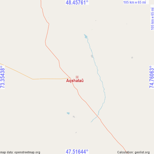
| Upper-left | 48.45761°, | 73.35438° |
| Center: | 47.98917°, | 74.0575° |
| Lower-right: | 47.51644°, | 74.76063° |
| Map W x H: | 104.6×104.6 km | = 65×65mi |
| max Lat: | 54.90596° ⇑55.9% North |
| Aqshataū: | 47.98917° |
| min Lat: | ⇓44.1% South 40.66338° |
| min Long | Aqshataū | max Long |
| 46.83361° | 74.0575° | 84.87144° |
| W 71.5%⇐ | ⇒28.5% E |
Elevation
Elevation of Aqshataū is 751 m = 2464 ft, and this is 394.5 m = 1294 ft above average elevation for this country.
| Max E: |
1847 m = 6060 ft | 8.1% |
| Aqshataū | 751 m 2464 ft | |
| Avg. | 356.5 m = 1170 ft | |
Min E: |
-26 m = -85 ft | 91.9% |
See also: Kazakhstan elevation on elevation.city.
Geographical zone
Aqshataū is located in North temperate zone (between Tropic of Cancer and the Arctic Circle). Distance of this North polar circle is 2065.3 km =1283.3 mi to North.| Distance of | km | miles | from Aqshataū |
|---|---|---|---|
| North Pole | 4671.2 | 2902.5 | to North |
| Arctic Circle | 2065.3 | 1283.3 | to North |
| Tropic Cancer | 2730 | 1696.3 | to South |
| Equator | 5335.9 | 3315.6 | to South |


Nearby cities:
15 places around Aqshataū: (largest is in red/bold)
• Abay
202.9 km =126.1 mi,  334°
334°
• Aksu-Ayuly
91.1 km =56.6 mi,  341°
341°
• Aktau
91.2 km =56.7 mi,  273°
273°
• Aktogay
94.4 km =58.7 mi,  77°
77°
• Aqadyr
94 km =58.4 mi,  288°
288°
• Atasū
194.5 km =120.9 mi, 293°
• Balqash
145.2 km =90.2 mi,  150°
150°
• Gülshat
152.8 km =94.9 mi,  171°
171°
• Koktal
188.9 km =117.4 mi,  347°
347°
• Moyynty
99.9 km =62.1 mi,  211°
211°
• Qarqaraly
189.3 km =117.6 mi,  33°
33°
• Saryshaghan
210.6 km =130.9 mi,  189°
189°
• Shashūbay
149.9 km =93.1 mi, 150°
• Verkhniye Kayrakty
96.1 km =59.7 mi,  323°
323°
• Zharyk
132 km =82 mi, 316°
Sources, notices
• [Note1] Compared only with cities in Kazakhstan existing in our database
• [Src1] Map data: © OpenStreetMap contributors (CC-BY-SA)
• [Src2] Other city data from geonames.org with taken over terms of usage.
• [Src3] Geographical zone / Annual Mean Temperature by Robert A. Rohde @ Wikipedia
