Saryshaghan geodata
Saryshaghan (Karaganda) is a populated place; located in Kazakhstan in Asia/Almaty (GMT+5) time zone. With population of 4,365 people, there are 205 cities with bigger population in this country. Compared to other cities in Kazakhstan, 66.7% of cities are located further ↑North; 68.9% of cities are located further ←West and 53% of cities have lower elevation than Saryshaghan. Note1


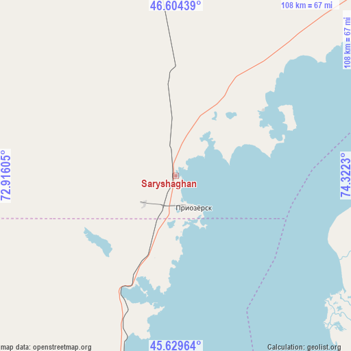
Saryshaghan GPS coordinates[2]
46° 7' 9.012" North, 73° 37' 9.012" East
| Map corner | latitude | longitude |
|---|---|---|
| Upper-left | 46.60439°, | 72.91605° |
| Center: | 46.11917°, | 73.61917° |
| Lower-right: | 45.62964°, | 74.3223° |
| Map W x H: | 108.4×108.4 km | = 67.4×67.4mi |
| max Lat: | 54.90596° ⇑66.7% North |
| Saryshaghan: | 46.11917° |
| min Lat: | ⇓33.3% South 40.66338° |
| min Long | Saryshaghan | max Long |
| 46.83361° | 73.61917° | 84.87144° |
| W 68.9%⇐ | ⇒31.1% E |
Elevation
Elevation of Saryshaghan is 349 m = 1145 ft, and this is 7.5 m = 25 ft below average elevation for this country.
| Max E: |
1847 m = 6060 ft | 47% |
| Avg. | 356.5 m = 1170 ft | |
| Saryshaghan | 349 m = 1145 ft | |
Min E: |
-26 m = -85 ft | 53% |
See also: Kazakhstan elevation on elevation.city.
Geographical zone
Saryshaghan is located in North temperate zone (between Tropic of Cancer and the Arctic Circle). Distance of this North polar circle is 2273.2 km =1412.5 mi to North.| Distance of | km | miles | from Saryshaghan |
|---|---|---|---|
| North Pole | 4879.1 | 3031.7 | to North |
| Arctic Circle | 2273.2 | 1412.5 | to North |
| Tropic Cancer | 2522.1 | 1567.2 | to South |
| Equator | 5128 | 3186.4 | to South |


Nearby cities:
15 places around Saryshaghan: (largest is in red/bold)
• Aktau
221 km =137.3 mi,  344°
344°
• Aqadyr
244.9 km =152.2 mi,  346°
346°
• Aqbaqay
140.4 km =87.2 mi,  207°
207°
• Aqshataū
210.6 km =130.9 mi,  9°
9°
• Balqash
132.9 km =82.6 mi,  52°
52°
• Gülshat
80.1 km =49.8 mi,  44°
44°
• Karabas
203.4 km =126.4 mi,  76°
76°
• Khantaū
210.8 km =131 mi,  176°
176°
• Moyynkum
210.8 km =131 mi,  194°
194°
• Moyynty
124 km =77.1 mi, 351°
• Mynaral
78.3 km =48.7 mi, 176°
• Priozersk
11.7 km =7.3 mi,  146°
146°
• Shashūbay
133.7 km =83.1 mi, 54°
• Zhambyl
208.3 km =129.4 mi,  305°
305°
• Ülken
104.7 km =65.1 mi,  164°
164°
Sources, notices
• [Note1] Compared only with cities in Kazakhstan existing in our database
• [Src1] Map data: © OpenStreetMap contributors (CC-BY-SA)
• [Src2] Other city data from geonames.org with taken over terms of usage.
• [Src3] Geographical zone / Annual Mean Temperature by Robert A. Rohde @ Wikipedia
