Huameung geodata
Huameung (Houaphan) is a seat of a second-order administrative division; located in Laos in Asia/Vientiane (GMT+7) time zone. In our database, there are 24 cities with bigger population. Compared to other cities in Laos, 71.2% of cities are located further ↓South; 53.8% of cities are located further →East and 98.1% of cities have lower elevation than Huameung. Note1


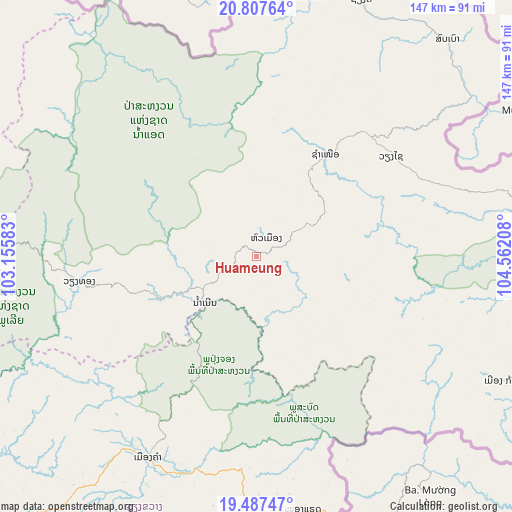
Huameung GPS coordinates[2]
20° 8' 56.22" North, 103° 51' 32.22" East
| Map corner | latitude | longitude |
|---|---|---|
| Upper-left | 20.80764°, | 103.15583° |
| Center: | 20.14895°, | 103.85895° |
| Lower-right: | 19.48747°, | 104.56208° |
| Map W x H: | 146.8×146.8 km | = 91.2×91.2mi |
| max Lat: | 21.6808° ⇑28.8% North |
| Huameung: | 20.14895° |
| min Lat: | ⇓71.2% South 14.11785° |
| min Long | Huameung | max Long |
| 100.4178° | 103.85895° | 107.26667° |
| W 46.2%⇐ | ⇒53.8% E |
Elevation
Elevation of Huameung is 1440 m = 4724 ft, and this is 966.4 m = 3171 ft above average elevation for this country.
| Max E: |
1722 m = 5650 ft | 1.9% |
| Huameung | 1440 m 4724 ft | |
| Avg. | 473.6 m = 1554 ft | |
Min E: |
83 m = 272 ft | 98.1% |
See also: Laos elevation on elevation.city.
Geographical zone
Huameung is located in North Torrid zone (between Equator and Tropic of Cancer). Distance of this Northern Tropic circle is 365.6 km =227.2 mi to North.| Distance of | km | miles | from Huameung |
|---|---|---|---|
| North Pole | 7766.7 | 4826 | to North |
| Arctic Circle | 5160.8 | 3206.8 | to North |
| Tropic Cancer | 365.6 | 227.2 | to North |
| Equator | 2240.4 | 1392.1 | to South |


Nearby cities:
15 places around Huameung: (largest is in red/bold)
• Ban Namnga
163.8 km =101.8 mi,  313°
313°
• Ban Pakla
198.8 km =123.5 mi,  293°
293°
• Ban Xiang-Ngeun
180.5 km =112.2 mi,  256°
256°
• Borikhan
176.9 km =109.9 mi,  184°
184°
• Khoa
174.6 km =108.5 mi, 306°
• Luang Prabang
182.5 km =113.4 mi, 260°
• Muang Kasi
196.8 km =122.3 mi,  238°
238°
• Muang Mok
138.6 km =86.1 mi,  173°
173°
• Muang Phônsavan
104.5 km =64.9 mi,  221°
221°
• Pakxan
196.2 km =121.9 mi,  186°
186°
• Viangxai
47.6 km =29.6 mi,  53°
53°
• Viengthong
51 km =31.7 mi, 292°
• Viengxay
55 km =34.2 mi,  67°
67°
• Xam Nua
35.5 km =22.1 mi,  33°
33°
• Xamtay
72.4 km =45 mi,  108°
108°
Sources, notices
• [Note1] Compared only with cities in Laos existing in our database
• [Src1] Map data: © OpenStreetMap contributors (CC-BY-SA)
• [Src2] Other city data from geonames.org with taken over terms of usage.
• [Src3] Geographical zone / Annual Mean Temperature by Robert A. Rohde @ Wikipedia
