Viengxay geodata
Viengxay (Houaphan) is a seat of a second-order administrative division; located in Laos in Asia/Vientiane (GMT+7) time zone. In our database, there are 24 cities with bigger population. Compared to other cities in Laos, 78.8% of cities are located further ↓South; 57.7% of cities are located further ←West and 76.9% of cities have lower elevation than Viengxay. Note1


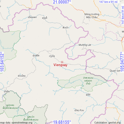
Viengxay GPS coordinates[2]
20° 20' 31.992" North, 104° 20' 40.704" East
| Map corner | latitude | longitude |
|---|---|---|
| Upper-left | 21.00007°, | 103.64152° |
| Center: | 20.34222°, | 104.34464° |
| Lower-right: | 19.68155°, | 105.04777° |
| Map W x H: | 146.6×146.6 km | = 91.1×91.1mi |
| max Lat: | 21.6808° ⇑21.2% North |
| Viengxay: | 20.34222° |
| min Lat: | ⇓78.8% South 14.11785° |
| min Long | Viengxay | max Long |
| 100.4178° | 104.34464° | 107.26667° |
| W 57.7%⇐ | ⇒42.3% E |
Elevation
Elevation of Viengxay is 662 m = 2172 ft, and this is 188.4 m = 618 ft above average elevation for this country.
| Max E: |
1722 m = 5650 ft | 23.1% |
| Viengxay | 662 m 2172 ft | |
| Avg. | 473.6 m = 1554 ft | |
Min E: |
83 m = 272 ft | 76.9% |
See also: Laos elevation on elevation.city.
Geographical zone
Viengxay is located in North Torrid zone (between Equator and Tropic of Cancer). Distance of this Northern Tropic circle is 344.1 km =213.8 mi to North.| Distance of | km | miles | from Viengxay |
|---|---|---|---|
| North Pole | 7745.2 | 4812.6 | to North |
| Arctic Circle | 5139.3 | 3193.4 | to North |
| Tropic Cancer | 344.1 | 213.8 | to North |
| Equator | 2261.8 | 1405.4 | to South |


Nearby cities:
15 places around Viengxay: (largest is in red/bold)
• Ban Nahin
233.9 km =145.3 mi,  183°
183°
• Ban Namnga
192 km =119.3 mi,  298°
298°
• Ban Xiang-Ngeun
235 km =146 mi,  253°
253°
• Borikhan
208.2 km =129.4 mi,  198°
198°
• Huameung
55 km =34.2 mi, 247°
• Khoa
208 km =129.2 mi,  293°
293°
• Luang Prabang
236.2 km =146.8 mi,  257°
257°
• Muang Mok
163.1 km =101.3 mi,  192°
192°
• Muang Phônsavan
156.2 km =97.1 mi,  230°
230°
• Pakkading
227.3 km =141.2 mi, 189°
• Pakxan
228.2 km =141.8 mi, 198°
• Viangxai
14.5 km =9 mi, 299°
• Viengthong
97.6 km =60.6 mi,  269°
269°
• Xam Nua
32.3 km =20.1 mi,  284°
284°
• Xamtay
47.7 km =29.6 mi,  157°
157°
Sources, notices
• [Note1] Compared only with cities in Laos existing in our database
• [Src1] Map data: © OpenStreetMap contributors (CC-BY-SA)
• [Src2] Other city data from geonames.org with taken over terms of usage.
• [Src3] Geographical zone / Annual Mean Temperature by Robert A. Rohde @ Wikipedia
