Birzai geodata
Birzai (Panevėžys) is a populated place; located in Lithuania in Europe/Vilnius (GMT+3) time zone. With population of 14,911 people, there are 35 cities with bigger population in this country. Compared to other cities in Lithuania, 94.8% of cities are located further ↓South; 69.4% of cities are located further ←West and 80.6% of cities have higher elevation than Birzai. Note1


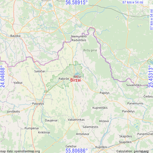
Birzai GPS coordinates[2]
56° 12' 0" North, 24° 45' 0" East
| Map corner | latitude | longitude |
|---|---|---|
| Upper-left | 56.58915°, | 24.04688° |
| Center: | 56.2°, | 24.75° |
| Lower-right: | 55.80686°, | 25.45313° |
| Map W x H: | 87×87 km | = 54.1×54.1mi |
| max Lat: | 56.36149° ⇑5.2% North |
| Birzai: | 56.2° |
| min Lat: | ⇓94.8% South 54.01573° |
| min Long | Birzai | max Long |
| 20.99651° | 24.75° | 26.43984° |
| W 69.4%⇐ | ⇒30.6% E |
Elevation
Elevation of Birzai is 53 m = 174 ft, and this is 37.7 m = 124 ft below average elevation for this country.
| Max E: |
204 m = 669 ft | 80.6% |
| Avg. | 90.7 m = 298 ft | |
| Birzai | 53 m = 174 ft | |
Min E: |
-1 m = -3 ft | 19.4% |
See also: Lithuania elevation on elevation.city.
Geographical zone
Birzai is located in North temperate zone (between Tropic of Cancer and the Arctic Circle). Distance of this North polar circle is 1152.3 km =716 mi to North.| Distance of | km | miles | from Birzai |
|---|---|---|---|
| North Pole | 3758.2 | 2335.2 | to North |
| Arctic Circle | 1152.3 | 716 | to North |
| Tropic Cancer | 3642.9 | 2263.6 | to South |
| Equator | 6248.9 | 3882.9 | to South |


Nearby cities:
15 places around Birzai: (largest is in red/bold)
• Anyksciai
78.2 km =48.6 mi,  163°
163°
• Joniškis
70.3 km =43.7 mi,  273°
273°
• Juodupė
54.6 km =33.9 mi,  103°
103°
• Kupiskis
42.5 km =26.4 mi, 160°
• Linkuva
49.9 km =31 mi,  255°
255°
• Naujamiestis
68.1 km =42.3 mi,  213°
213°
• Obeliai
36 km =22.4 mi,  135°
135°
• Pakruojis
60.7 km =37.7 mi,  246°
246°
• Pandėlys
35.3 km =21.9 mi,  123°
123°
• Panevėžys
57.6 km =35.8 mi, 205°
• Pasvalys
26.6 km =16.5 mi,  233°
233°
• Ramygala
81.3 km =50.5 mi,  200°
200°
• Rokiškis
58.9 km =36.6 mi, 117°
• Vabalninkas
24.3 km =15.1 mi,  180°
180°
• Šeduva
79.6 km =49.5 mi, 230°
Sources, notices
• [Note1] Compared only with cities in Lithuania existing in our database
• [Src1] Map data: © OpenStreetMap contributors (CC-BY-SA)
• [Src2] Other city data from geonames.org with taken over terms of usage.
• [Src3] Geographical zone / Annual Mean Temperature by Robert A. Rohde @ Wikipedia
