Tobruk geodata
Tobruk (Al Buţnān) is a seat of a first-order administrative division; located in Libya in Africa/Tripoli (GMT+2) time zone. With population of 121,052 people, there are 12 cities with bigger population in this country. Compared to other cities in Libya, 56.6% of cities are located further ↓South; 96.2% of cities are located further ←West and 66% of cities have higher elevation than Tobruk. Note1


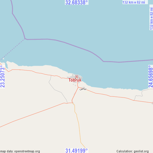
Tobruk GPS coordinates[2]
32° 5' 22.668" North, 23° 57' 13.86" East
| Map corner | latitude | longitude |
|---|---|---|
| Upper-left | 32.68338°, | 23.25073° |
| Center: | 32.08963°, | 23.95385° |
| Lower-right: | 31.49199°, | 24.65698° |
| Map W x H: | 132.5×132.5 km | = 82.3×82.3mi |
| max Lat: | 32.94699° ⇑43.4% North |
| Tobruk: | 32.08963° |
| min Lat: | ⇓56.6% South 24.1989° |
| min Long | Tobruk | max Long |
| 9.50072° | 23.95385° | 25.0866° |
| W 96.2%⇐ | ⇒3.8% E |
Elevation
Elevation of Tobruk is 21 m = 69 ft, and this is 211.2 m = 693 ft below average elevation for this country.
| Max E: |
704 m = 2310 ft | 66% |
| Avg. | 232.2 m = 762 ft | |
| Tobruk | 21 m = 69 ft | |
Min E: |
3 m = 10 ft | 34% |
See also: Tobruk elevation on elevation.city.
Geographical zone
Tobruk is located in North temperate zone (between Tropic of Cancer and the Arctic Circle). Distance of this Northern Tropic circle is 962.1 km =597.8 mi to South.| Distance of | km | miles | from Tobruk |
|---|---|---|---|
| North Pole | 6439 | 4001 | to North |
| Arctic Circle | 3833.1 | 2381.8 | to North |
| Tropic Cancer | 962.1 | 597.8 | to South |
| Equator | 3568 | 2217.1 | to South |


Nearby cities:
13 places around Tobruk: (largest is in red/bold)
• Ajdabiya
383.5 km =238.3 mi,  247°
247°
• Al Abyār
316.3 km =196.5 mi,  272°
272°
• Al Bardīyah
113.2 km =70.3 mi,  109°
109°
• Al Bayḑā’
219.5 km =136.4 mi,  289°
289°
• Al Jaghbūb
266.4 km =165.5 mi,  168°
168°
• Al Marj
297.1 km =184.6 mi,  278°
278°
• Al Qubbah
177 km =110 mi, 294°
• Az Zuwaytīnah
384.7 km =239 mi, 250°
• Benghazi
365.9 km =227.4 mi, 270°
• Darnah
144.8 km =90 mi,  301°
301°
• Gialo
410.4 km =255 mi,  214°
214°
• Qaryat Sulūq
352.6 km =219.1 mi,  262°
262°
• Tūkrah
320.9 km =199.4 mi, 278°
Sources, notices
• [Note1] Compared only with cities in Libya existing in our database
• [Src1] Map data: © OpenStreetMap contributors (CC-BY-SA)
• [Src2] Other city data from geonames.org with taken over terms of usage.
• [Src3] Geographical zone / Annual Mean Temperature by Robert A. Rohde @ Wikipedia
