Qaryat Sulūq geodata
Qaryat Sulūq (Banghāzī) is a populated place; located in Libya in Africa/Tripoli (GMT+2) time zone. With population of 15,543 people, there are 41 cities with bigger population in this country. Compared to other cities in Libya, 56.6% of cities are located further ↑North; 75.5% of cities are located further ←West and 52.8% of cities have higher elevation than Qaryat Sulūq. Note1


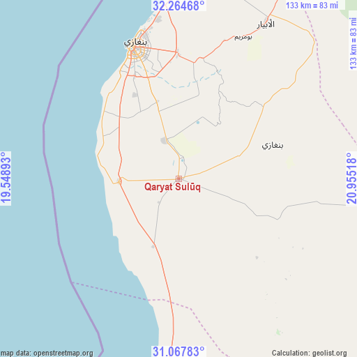
Qaryat Sulūq GPS coordinates[2]
31° 40' 5.448" North, 20° 15' 7.38" East
| Map corner | latitude | longitude |
|---|---|---|
| Upper-left | 32.26468°, | 19.54893° |
| Center: | 31.66818°, | 20.25205° |
| Lower-right: | 31.06783°, | 20.95518° |
| Map W x H: | 133.1×133.1 km | = 82.7×82.7mi |
| max Lat: | 32.94699° ⇑56.6% North |
| Qaryat Sulūq: | 31.66818° |
| min Lat: | ⇓43.4% South 24.1989° |
| min Long | Qaryat Sulūq | max Long |
| 9.50072° | 20.25205° | 25.0866° |
| W 75.5%⇐ | ⇒24.5% E |
Elevation
Elevation of Qaryat Sulūq is 55 m = 180 ft, and this is 177.2 m = 581 ft below average elevation for this country.
| Max E: |
704 m = 2310 ft | 52.8% |
| Avg. | 232.2 m = 762 ft | |
| Qaryat Sulūq | 55 m = 180 ft | |
Min E: |
3 m = 10 ft | 47.2% |
See also: Libya elevation on elevation.city.
Geographical zone
Qaryat Sulūq is located in North temperate zone (between Tropic of Cancer and the Arctic Circle). Distance of this Northern Tropic circle is 915.3 km =568.7 mi to South.| Distance of | km | miles | from Qaryat Sulūq |
|---|---|---|---|
| North Pole | 6485.9 | 4030.2 | to North |
| Arctic Circle | 3880 | 2410.9 | to North |
| Tropic Cancer | 915.3 | 568.7 | to South |
| Equator | 3521.2 | 2188 | to South |


Nearby cities:
15 places around Qaryat Sulūq: (largest is in red/bold)
• Ajdabiya
101.5 km =63.1 mi,  181°
181°
• Al Abyār
66.5 km =41.3 mi,  29°
29°
• Al Bayḑā’
186.6 km =115.9 mi,  49°
49°
• Al Burayqah
154.5 km =96 mi,  204°
204°
• Al Marj
106.6 km =66.2 mi, 30°
• Al Qubbah
222.8 km =138.4 mi,  57°
57°
• Awjilah
301.5 km =187.3 mi,  160°
160°
• Az Zuwaytīnah
80.6 km =50.1 mi,  188°
188°
• Benghazi
52.6 km =32.7 mi,  340°
340°
• Darnah
255.4 km =158.7 mi, 61°
• Gialo
318.3 km =197.8 mi, 156°
• Marādah
290.1 km =180.3 mi, 200°
• Qasr Abu Hadi
347.8 km =216.1 mi,  258°
258°
• Sirte
351.2 km =218.2 mi, 261°
• Tūkrah
101.1 km =62.8 mi,  17°
17°
Sources, notices
• [Note1] Compared only with cities in Libya existing in our database
• [Src1] Map data: © OpenStreetMap contributors (CC-BY-SA)
• [Src2] Other city data from geonames.org with taken over terms of usage.
• [Src3] Geographical zone / Annual Mean Temperature by Robert A. Rohde @ Wikipedia
