Al Bayḑā’ geodata
Al Bayḑā’ (Al Jabal al Akhḑar) is a seat of a first-order administrative division; located in Libya in Africa/Tripoli (GMT+2) time zone. With population of 74,594 people, there are 19 cities with bigger population in this country. Compared to other cities in Libya, 88.7% of cities are located further ↓South; 86.8% of cities are located further ←West and 88.7% of cities have lower elevation than Al Bayḑā’. Note1


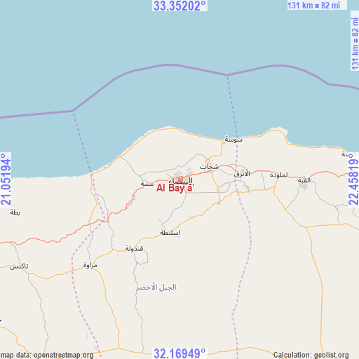
Al Bayḑā’ GPS coordinates[2]
32° 45' 45.792" North, 21° 45' 18.216" East
| Map corner | latitude | longitude |
|---|---|---|
| Upper-left | 33.35202°, | 21.05194° |
| Center: | 32.76272°, | 21.75506° |
| Lower-right: | 32.16949°, | 22.45819° |
| Map W x H: | 131.5×131.5 km | = 81.7×81.7mi |
| max Lat: | 32.94699° ⇑11.3% North |
| Al Bayḑā’: | 32.76272° |
| min Lat: | ⇓88.7% South 24.1989° |
| min Long | Al Bayḑā’ | max Long |
| 9.50072° | 21.75506° | 25.0866° |
| W 86.8%⇐ | ⇒13.2% E |
Elevation
Elevation of Al Bayḑā’ is 631 m = 2070 ft, and this is 398.8 m = 1308 ft above average elevation for this country.
| Max E: |
704 m = 2310 ft | 11.3% |
| Al Bayḑā’ | 631 m 2070 ft | |
| Avg. | 232.2 m = 762 ft | |
Min E: |
3 m = 10 ft | 88.7% |
See also: Al Bayḑā’ elevation on elevation.city.
Geographical zone
Al Bayḑā’ is located in North temperate zone (between Tropic of Cancer and the Arctic Circle). Distance of this Northern Tropic circle is 1037 km =644.4 mi to South.| Distance of | km | miles | from Al Bayḑā’ |
|---|---|---|---|
| North Pole | 6364.2 | 3954.5 | to North |
| Arctic Circle | 3758.3 | 2335.3 | to North |
| Tropic Cancer | 1037 | 644.4 | to South |
| Equator | 3642.9 | 2263.6 | to South |


Nearby cities:
14 places around Al Bayḑā’: (largest is in red/bold)
• Ajdabiya
265.9 km =165.2 mi,  212°
212°
• Al Abyār
126 km =78.3 mi,  239°
239°
• Al Bardīyah
332.6 km =206.7 mi,  109°
109°
• Al Burayqah
333.6 km =207.3 mi,  218°
218°
• Al Marj
91.8 km =57 mi,  250°
250°
• Al Qubbah
45.4 km =28.2 mi,  90°
90°
• Awjilah
408.8 km =254 mi,  186°
186°
• Az Zuwaytīnah
253.7 km =157.6 mi, 217°
• Benghazi
173.9 km =108.1 mi, 245°
• Darnah
82.4 km =51.2 mi, 89°
• Gialo
415.1 km =257.9 mi,  182°
182°
• Qaryat Sulūq
186.6 km =115.9 mi,  229°
229°
• Tobruk
219.5 km =136.4 mi, 109°
• Tūkrah
113 km =70.2 mi,  257°
257°
Sources, notices
• [Note1] Compared only with cities in Libya existing in our database
• [Src1] Map data: © OpenStreetMap contributors (CC-BY-SA)
• [Src2] Other city data from geonames.org with taken over terms of usage.
• [Src3] Geographical zone / Annual Mean Temperature by Robert A. Rohde @ Wikipedia
