Gialo geodata
Gialo (Al Wāḩāt) is a populated place; located in Libya in Africa/Tripoli (GMT+2) time zone. With population of 3,334 people, there are 51 cities with bigger population in this country. Compared to other cities in Libya, 81.1% of cities are located further ↑North; 84.9% of cities are located further ←West and 58.5% of cities have higher elevation than Gialo. Note1


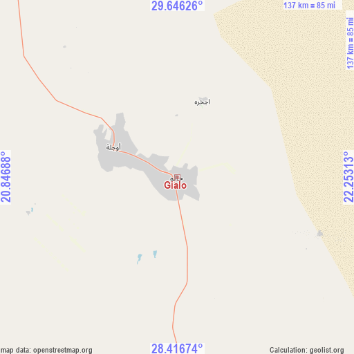
Gialo GPS coordinates[2]
29° 1' 59.988" North, 21° 33' 0" East
| Map corner | latitude | longitude |
|---|---|---|
| Upper-left | 29.64626°, | 20.84688° |
| Center: | 29.03333°, | 21.55° |
| Lower-right: | 28.41674°, | 22.25313° |
| Map W x H: | 136.7×136.7 km | = 84.9×84.9mi |
| max Lat: | 32.94699° ⇑81.1% North |
| Gialo: | 29.03333° |
| min Lat: | ⇓18.9% South 24.1989° |
| min Long | Gialo | max Long |
| 9.50072° | 21.55° | 25.0866° |
| W 84.9%⇐ | ⇒15.1% E |
Elevation
Elevation of Gialo is 41 m = 135 ft, and this is 191.2 m = 627 ft below average elevation for this country.
| Max E: |
704 m = 2310 ft | 58.5% |
| Avg. | 232.2 m = 762 ft | |
| Gialo | 41 m = 135 ft | |
Min E: |
3 m = 10 ft | 41.5% |
See also: Libya elevation on elevation.city.
Geographical zone
Gialo is located in North temperate zone (between Tropic of Cancer and the Arctic Circle). Distance of this Northern Tropic circle is 622.3 km =386.7 mi to South.| Distance of | km | miles | from Gialo |
|---|---|---|---|
| North Pole | 6778.9 | 4212.2 | to North |
| Arctic Circle | 4173 | 2593 | to North |
| Tropic Cancer | 622.3 | 386.7 | to South |
| Equator | 3228.2 | 2005.9 | to South |


Nearby cities:
15 places around Gialo: (largest is in red/bold)
• Ajdabiya
230.1 km =143 mi,  326°
326°
• Al Abyār
362.6 km =225.3 mi,  345°
345°
• Al Bayḑā’
415.1 km =257.9 mi,  2°
2°
• Al Burayqah
244.4 km =151.9 mi,  308°
308°
• Al Jaghbūb
298 km =185.2 mi,  74°
74°
• Al Marj
390.7 km =242.8 mi, 349°
• Al Qubbah
419.2 km =260.5 mi,  9°
9°
• Awjilah
26.9 km =16.7 mi,  288°
288°
• Az Zuwaytīnah
253.9 km =157.8 mi, 327°
• Benghazi
370.8 km =230.4 mi,  337°
337°
• Darnah
427.9 km =265.9 mi, 14°
• Marādah
228.8 km =142.2 mi,  275°
275°
• Qaryat Sulūq
318.3 km =197.8 mi, 336°
• Tobruk
410.4 km =255 mi,  34°
34°
• Tūkrah
400.1 km =248.6 mi, 346°
Sources, notices
• [Note1] Compared only with cities in Libya existing in our database
• [Src1] Map data: © OpenStreetMap contributors (CC-BY-SA)
• [Src2] Other city data from geonames.org with taken over terms of usage.
• [Src3] Geographical zone / Annual Mean Temperature by Robert A. Rohde @ Wikipedia
