Benghazi geodata
Benghazi (Banghāzī) is a seat of a first-order administrative division; located in Libya in Africa/Tripoli (GMT+2) time zone. With population of 650,629 people, there is 1 city with bigger population in this country. Compared to other cities in Libya, 58.5% of cities are located further ↓South; 69.8% of cities are located further ←West and 100% of cities have higher elevation than Benghazi. Note1


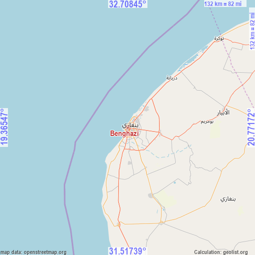
Benghazi GPS coordinates[2]
32° 6' 53.496" North, 20° 4' 6.924" East
| Map corner | latitude | longitude |
|---|---|---|
| Upper-left | 32.70845°, | 19.36547° |
| Center: | 32.11486°, | 20.06859° |
| Lower-right: | 31.51739°, | 20.77172° |
| Map W x H: | 132.4×132.4 km | = 82.3×82.3mi |
| max Lat: | 32.94699° ⇑41.5% North |
| Benghazi: | 32.11486° |
| min Lat: | ⇓58.5% South 24.1989° |
| min Long | Benghazi | max Long |
| 9.50072° | 20.06859° | 25.0866° |
| W 69.8%⇐ | ⇒30.2% E |
Elevation
Elevation of Benghazi is 3 m = 10 ft, and this is 229.2 m = 752 ft below average elevation for this country.
| Max E: |
704 m = 2310 ft | 100% |
| Avg. | 232.2 m = 762 ft | |
| Benghazi | 3 m = 10 ft | |
Min E: |
3 m = 10 ft | 0% |
See also: Benghazi elevation on elevation.city.
Geographical zone
Benghazi is located in North temperate zone (between Tropic of Cancer and the Arctic Circle). Distance of this Northern Tropic circle is 964.9 km =599.6 mi to South.| Distance of | km | miles | from Benghazi |
|---|---|---|---|
| North Pole | 6436.2 | 3999.3 | to North |
| Arctic Circle | 3830.3 | 2380 | to North |
| Tropic Cancer | 964.9 | 599.6 | to South |
| Equator | 3570.8 | 2218.8 | to South |


Nearby cities:
15 places around Benghazi: (largest is in red/bold)
• Ajdabiya
151.9 km =94.4 mi,  174°
174°
• Al Abyār
50.4 km =31.3 mi,  80°
80°
• Al Bayḑā’
173.9 km =108.1 mi,  65°
65°
• Al Burayqah
195.7 km =121.6 mi,  193°
193°
• Al Marj
82.9 km =51.5 mi,  59°
59°
• Al Qubbah
216 km =134.2 mi, 70°
• Awjilah
354.1 km =220 mi,  160°
160°
• Az Zuwaytīnah
129.4 km =80.4 mi,  177°
177°
• Darnah
251.7 km =156.4 mi, 73°
• Marādah
332.3 km =206.5 mi, 194°
• Qaryat Sulūq
52.6 km =32.7 mi, 160°
• Qasr Abu Hadi
343.6 km =213.5 mi,  250°
250°
• Sirte
344.4 km =214 mi, 252°
• Tobruk
365.9 km =227.4 mi,  90°
90°
• Tūkrah
66.9 km =41.6 mi,  45°
45°
In other languages:
- In Spanish: Bengasi
- In German: Banghazi
- In Italian: Bengasi
- In Russian: Бенгази
- In Chinese: 班加西
Sources, notices
• [Note1] Compared only with cities in Libya existing in our database
• [Src1] Map data: © OpenStreetMap contributors (CC-BY-SA)
• [Src2] Other city data from geonames.org with taken over terms of usage.
• [Src3] Geographical zone / Annual Mean Temperature by Robert A. Rohde @ Wikipedia
