Al Abyār geodata
Al Abyār (Al Marj) is a populated place; located in Libya in Africa/Tripoli (GMT+2) time zone. With population of 32,563 people, there are 28 cities with bigger population in this country. Compared to other cities in Libya, 62.3% of cities are located further ↓South; 79.2% of cities are located further ←West and 60.4% of cities have lower elevation than Al Abyār. Note1


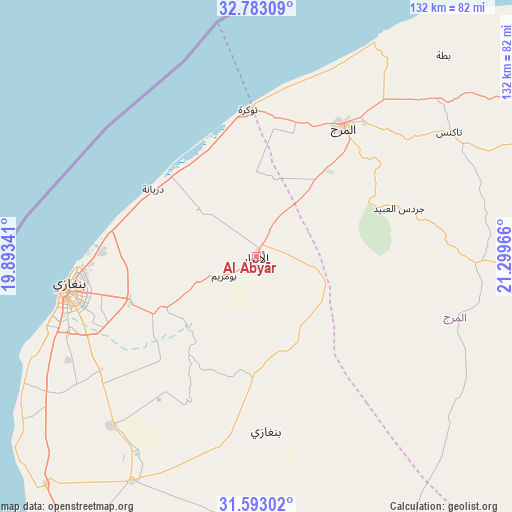
Al Abyār GPS coordinates[2]
32° 11' 24" North, 20° 35' 47.508" East
| Map corner | latitude | longitude |
|---|---|---|
| Upper-left | 32.78309°, | 19.89341° |
| Center: | 32.19°, | 20.59653° |
| Lower-right: | 31.59302°, | 21.29966° |
| Map W x H: | 132.3×132.3 km | = 82.2×82.2mi |
| max Lat: | 32.94699° ⇑37.7% North |
| Al Abyār: | 32.19° |
| min Lat: | ⇓62.3% South 24.1989° |
| min Long | Al Abyār | max Long |
| 9.50072° | 20.59653° | 25.0866° |
| W 79.2%⇐ | ⇒20.8% E |
Elevation
Elevation of Al Abyār is 289 m = 948 ft, and this is 56.8 m = 186 ft above average elevation for this country.
| Max E: |
704 m = 2310 ft | 39.6% |
| Al Abyār | 289 m 948 ft | |
| Avg. | 232.2 m = 762 ft | |
Min E: |
3 m = 10 ft | 60.4% |
See also: Libya elevation on elevation.city.
Geographical zone
Al Abyār is located in North temperate zone (between Tropic of Cancer and the Arctic Circle). Distance of this Northern Tropic circle is 973.3 km =604.8 mi to South.| Distance of | km | miles | from Al Abyār |
|---|---|---|---|
| North Pole | 6427.9 | 3994.1 | to North |
| Arctic Circle | 3822 | 2374.9 | to North |
| Tropic Cancer | 973.3 | 604.8 | to South |
| Equator | 3579.2 | 2224 | to South |


Nearby cities:
14 places around Al Abyār: (largest is in red/bold)
• Ajdabiya
163.3 km =101.5 mi,  192°
192°
• Al Bayḑā’
126 km =78.3 mi,  59°
59°
• Al Burayqah
220.9 km =137.3 mi,  206°
206°
• Al Marj
40.1 km =24.9 mi,  32°
32°
• Al Qubbah
166.6 km =103.5 mi,  67°
67°
• Awjilah
349 km =216.9 mi,  169°
169°
• Az Zuwaytīnah
144.8 km =90 mi,  198°
198°
• Benghazi
50.4 km =31.3 mi,  260°
260°
• Darnah
201.8 km =125.4 mi, 71°
• Gialo
362.6 km =225.3 mi, 165°
• Marādah
356 km =221.2 mi, 201°
• Qaryat Sulūq
66.5 km =41.3 mi, 209°
• Tobruk
316.3 km =196.5 mi,  92°
92°
• Tūkrah
38.3 km =23.8 mi,  357°
357°
Sources, notices
• [Note1] Compared only with cities in Libya existing in our database
• [Src1] Map data: © OpenStreetMap contributors (CC-BY-SA)
• [Src2] Other city data from geonames.org with taken over terms of usage.
• [Src3] Geographical zone / Annual Mean Temperature by Robert A. Rohde @ Wikipedia
