Ankazoabo geodata
Ankazoabo (Atsimo-Andrefana) is a populated place; located in Madagascar in Indian/Antananarivo (GMT+3) time zone. With population of 25,961 people, there are 45 cities with bigger population in this country. Compared to other cities in Madagascar, 78% of cities are located further ↑North; 93.5% of cities are located further →East and 56.9% of cities have lower elevation than Ankazoabo. Note1
Administrative division(s):
- Level 1: Atsimo-Andrefana
- Level 2: Ankazoabo District
- Level 3: Ankazoabo Sud
- Level 4: Ankalirano Mahafaly


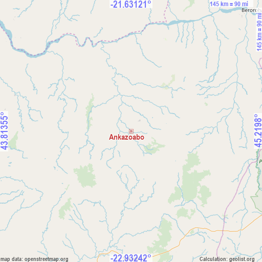
Ankazoabo GPS coordinates[2]
22° 16' 59.988" South, 44° 31' 0.012" East
| Map corner | latitude | longitude |
|---|---|---|
| Upper-left | -21.63121°, | 43.81355° |
| Center: | -22.28333°, | 44.51667° |
| Lower-right: | -22.93242°, | 45.2198° |
| Map W x H: | 144.7×144.7 km | = 89.9×89.9mi |
| max Lat: | -12.31732° ⇑78% North |
| Ankazoabo: | -22.28333° |
| min Lat: | ⇓22% South -25.3° |
| min Long | Ankazoabo | max Long |
| 43.65° | 44.51667° | 50.27876° |
| W 6.5%⇐ | ⇒93.5% E |
Elevation
Elevation of Ankazoabo is 398 m = 1306 ft, and this is 159.4 m = 523 ft below average elevation for this country.
| Max E: |
1763 m = 5784 ft | 43.1% |
| Avg. | 557.4 m = 1829 ft | |
| Ankazoabo | 398 m = 1306 ft | |
Min E: |
1 m = 3 ft | 56.9% |
See also: Madagascar elevation on elevation.city.
Geographical zone
Ankazoabo is located in South Torrid zone (between Equator and Tropic of Capricorn). Distance of this Southern Tropic circle is 128.2 km =79.7 mi to South.| Distance of | km | miles | from Ankazoabo |
|---|---|---|---|
| Equator | 2477.7 | 1539.6 | to North |
| Tropic Capricorn | 128.2 | 79.7 | to South |
| Antarctic Circle | 4923.5 | 3059.3 | to South |
| South Pole | 7529.4 | 4678.6 | to South |


Nearby cities:
15 places around Ankazoabo: (largest is in red/bold)
• Ambalasoa
178.1 km =110.7 mi,  121°
121°
• Ambalavao
254 km =157.8 mi,  78°
78°
• Anakao
177.6 km =110.4 mi,  209°
209°
• Antanimena
147.2 km =91.5 mi,  196°
196°
• Behompy
127.4 km =79.2 mi, 212°
• Beroroha
95.9 km =59.6 mi,  44°
44°
• Beteza
248.6 km =154.5 mi,  165°
165°
• Betioky
160.4 km =99.7 mi,  184°
184°
• Ihosy
166 km =103.1 mi,  94°
94°
• Ikalamavony
247.9 km =154 mi,  59°
59°
• Manja
96.4 km =59.9 mi,  348°
348°
• Morondava
222.7 km =138.4 mi, 354°
• Ranohira
93.5 km =58.1 mi,  103°
103°
• Sakaraha
68.6 km =42.6 mi, 178°
• Toliara
147.2 km =91.5 mi,  216°
216°
Sources, notices
• [Note1] Compared only with cities in Madagascar existing in our database
• [Src1] Map data: © OpenStreetMap contributors (CC-BY-SA)
• [Src2] Other city data from geonames.org with taken over terms of usage.
• [Src3] Geographical zone / Annual Mean Temperature by Robert A. Rohde @ Wikipedia
