Taroa geodata
Taroa (Maloelap Atoll) is a seat of a first-order administrative division; located in Marshall Islands in Pacific/Majuro (GMT+12) time zone. In our database, there are 20 cities with bigger population. Compared to other cities in Marshall Islands, 54.2% of cities are located further ↓South; 83.3% of cities are located further ←West and 50% of cities have lower elevation than Taroa. Note1


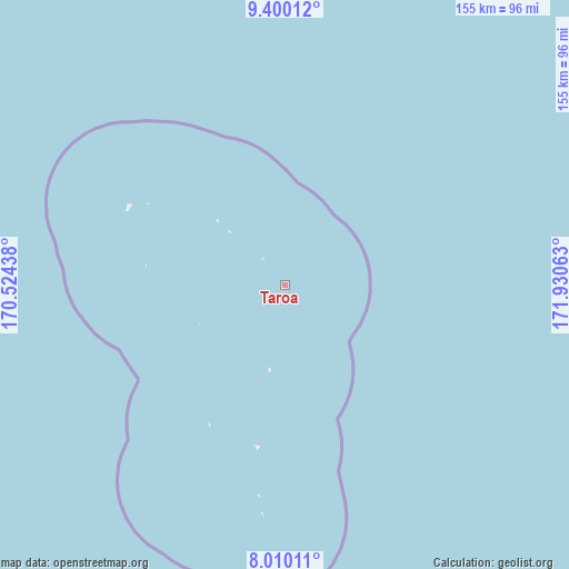
Taroa GPS coordinates[2]
8° 42' 20.736" North, 171° 13' 39" East
| Map corner | latitude | longitude |
|---|---|---|
| Upper-left | 9.40012°, | 170.52438° |
| Center: | 8.70576°, | 171.2275° |
| Lower-right: | 8.01011°, | 171.93063° |
| Map W x H: | 154.6×154.6 km | = 96.1×96.1mi |
| max Lat: | 11.34735° ⇑45.8% North |
| Taroa: | 8.70576° |
| min Lat: | ⇓54.2% South 4.58199° |
| min Long | Taroa | max Long |
| 162.33733° | 171.2275° | 171.73502° |
| W 83.3%⇐ | ⇒16.7% E |
Elevation
Elevation of Taroa is 10 m = 33 ft, and this is 0.3 m = 1 ft above average elevation for this country.
| Max E: |
16 m = 52 ft | 50% |
| Taroa | 10 m 33 ft | |
| Avg. | 9.7 m = 32 ft | |
Min E: |
5 m = 16 ft | 50% |
See also: Marshall Islands elevation on elevation.city.
Geographical zone
Taroa is located in North Torrid zone (between Equator and Tropic of Cancer). Distance of Equator is 968 km =601.5 mi to South.| Distance of | km | miles | from Taroa |
|---|---|---|---|
| North Pole | 9039.1 | 5616.6 | to North |
| Arctic Circle | 6433.2 | 3997.4 | to North |
| Tropic Cancer | 1637.9 | 1017.7 | to North |
| Equator | 968 | 601.5 | to South |


Nearby cities:
15 places around Taroa: (largest is in red/bold)
• Ailuk
216.9 km =134.8 mi,  320°
320°
• Airuk
309 km =192 mi,  239°
239°
• Arno
185.7 km =115.4 mi,  168°
168°
• Aur
62.1 km =38.6 mi,  185°
185°
• Ebaye
383.4 km =238.2 mi,  271°
271°
• Jabat
269.7 km =167.6 mi,  246°
246°
• Jabor
355.5 km =220.9 mi,  209°
209°
• Likiep
244.4 km =151.9 mi,  300°
300°
• Loen
346.1 km =215.1 mi, 252°
• Majuro
180.5 km =112.2 mi, 174°
• Mejit
179 km =111.2 mi,  347°
347°
• Mili
297.1 km =184.6 mi, 169°
• RMI Capitol
180.5 km =112.2 mi, 174°
• Utrik
318.6 km =198 mi,  331°
331°
• Wotje
137 km =85.1 mi,  307°
307°
Sources, notices
• [Note1] Compared only with cities in Marshall Islands existing in our database
• [Src1] Map data: © OpenStreetMap contributors (CC-BY-SA)
• [Src2] Other city data from geonames.org with taken over terms of usage.
• [Src3] Geographical zone / Annual Mean Temperature by Robert A. Rohde @ Wikipedia
