Kayan geodata
Kayan (Rangoon) is a populated place; located in Myanmar in Asia/Yangon (GMT+6.5) time zone. With population of 40,322 people, there are 58 cities with bigger population in this country. Compared to other cities in Myanmar, 62.2% of cities are located further ↑North; 62.2% of cities are located further ←West and 85.1% of cities have higher elevation than Kayan. Note1


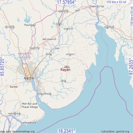
Kayan GPS coordinates[2]
16° 54' 28.872" North, 96° 33' 37.332" East
| Map corner | latitude | longitude |
|---|---|---|
| Upper-left | 17.57954°, | 95.85725° |
| Center: | 16.90802°, | 96.56037° |
| Lower-right: | 16.2341°, | 97.2635° |
| Map W x H: | 149.6×149.6 km | = 93×93mi |
| max Lat: | 25.38327° ⇑62.2% North |
| Kayan: | 16.90802° |
| min Lat: | ⇓37.8% South 9.98238° |
| min Long | Kayan | max Long |
| 92.89835° | 96.56037° | 99.88083° |
| W 62.2%⇐ | ⇒37.8% E |
Elevation
Elevation of Kayan is 13 m = 43 ft, and this is 175.9 m = 577 ft below average elevation for this country.
| Max E: |
1768 m = 5801 ft | 85.1% |
| Avg. | 188.9 m = 620 ft | |
| Kayan | 13 m = 43 ft | |
Min E: |
5 m = 16 ft | 14.9% |
See also: Kayan elevation on elevation.city.
Geographical zone
Kayan is located in North Torrid zone (between Equator and Tropic of Cancer). Distance of this Northern Tropic circle is 725.9 km =451.1 mi to North.| Distance of | km | miles | from Kayan |
|---|---|---|---|
| North Pole | 8127.1 | 5049.9 | to North |
| Arctic Circle | 5521.2 | 3430.7 | to North |
| Tropic Cancer | 725.9 | 451.1 | to North |
| Equator | 1880 | 1168.2 | to South |


Nearby cities:
15 places around Kayan: (largest is in red/bold)
• Bago
48.2 km =30 mi,  349°
349°
• Hpa-An
114.3 km =71 mi,  91°
91°
• Kanbe
63.5 km =39.5 mi,  249°
249°
• Kyaiklat
102.9 km =63.9 mi,  239°
239°
• Kyaikto
65.4 km =40.6 mi,  47°
47°
• Maubin
98.4 km =61.1 mi,  258°
258°
• Nyaungdon
99.1 km =61.6 mi,  278°
278°
• Pyapon
116.7 km =72.5 mi,  233°
233°
• Syriam
37 km =23 mi, 245°
• Thanatpin
42.7 km =26.5 mi,  2°
2°
• Tharyarwady
116.6 km =72.5 mi,  315°
315°
• Thaton
86.1 km =53.5 mi, 89°
• Thongwa
16.9 km =10.5 mi,  192°
192°
• Twante
70.7 km =43.9 mi, 251°
• Yangon
44.5 km =27.7 mi, 255°
Sources, notices
• [Note1] Compared only with cities in Myanmar existing in our database
• [Src1] Map data: © OpenStreetMap contributors (CC-BY-SA)
• [Src2] Other city data from geonames.org with taken over terms of usage.
• [Src3] Geographical zone / Annual Mean Temperature by Robert A. Rohde @ Wikipedia
