Erdenet geodata
Erdenet (Orhon) is a seat of a first-order administrative division; located in Mongolia in Asia/Ulaanbaatar (GMT+8) time zone. With population of 79,647 people, there is 1 city with bigger population in this country. Compared to other cities in Mongolia, 77.3% of cities are located further ↓South; 58.9% of cities are located further ←West and 55.2% of cities have higher elevation than Erdenet. Note1


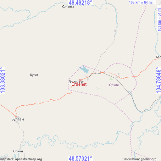
Erdenet GPS coordinates[2]
49° 1' 59.988" North, 104° 4' 59.988" East
| Map corner | latitude | longitude |
|---|---|---|
| Upper-left | 49.49218°, | 103.38021° |
| Center: | 49.03333°, | 104.08333° |
| Lower-right: | 48.57021°, | 104.78646° |
| Map W x H: | 102.5×102.5 km | = 63.7×63.7mi |
| max Lat: | 51.50725° ⇑22.7% North |
| Erdenet: | 49.03333° |
| min Lat: | ⇓77.3% South 42.84199° |
| min Long | Erdenet | max Long |
| 89.14358° | 104.08333° | 118.51014° |
| W 58.9%⇐ | ⇒41.1% E |
Elevation
Elevation of Erdenet is 1307 m = 4288 ft, and this is 109.5 m = 359 ft below average elevation for this country.
| Max E: |
2800 m = 9186 ft | 55.2% |
| Avg. | 1416.5 m = 4647 ft | |
| Erdenet | 1307 m = 4288 ft | |
Min E: |
619 m = 2031 ft | 44.8% |
See also: Erdenet elevation on elevation.city.
Geographical zone
Erdenet is located in North temperate zone (between Tropic of Cancer and the Arctic Circle). Distance of this North polar circle is 1949.2 km =1211.2 mi to North.| Distance of | km | miles | from Erdenet |
|---|---|---|---|
| North Pole | 4555.1 | 2830.4 | to North |
| Arctic Circle | 1949.2 | 1211.2 | to North |
| Tropic Cancer | 2846.1 | 1768.5 | to South |
| Equator | 5452 | 3387.7 | to South |


Nearby cities:
15 places around Erdenet: (largest is in red/bold)
• Bat-Öldziyt
104.1 km =64.7 mi,  150°
150°
• Bugat
30.6 km =19 mi,  276°
276°
• Bulgan
47 km =29.2 mi,  238°
238°
• Burgaltay
54.5 km =33.9 mi,  61°
61°
• Darhan
87.9 km =54.6 mi,  189°
189°
• Enhtal
96.8 km =60.1 mi,  75°
75°
• Hutag
108.7 km =67.5 mi,  291°
291°
• Ingettolgoy
48.3 km =30 mi,  350°
350°
• Jargalant
25.9 km =16.1 mi,  65°
65°
• Maanĭt
95.1 km =59.1 mi,  210°
210°
• Mandal
60.4 km =37.5 mi,  222°
222°
• Nart
95.8 km =59.5 mi, 82°
• Orgil
111.1 km =69 mi,  125°
125°
• Orhontuul
65.8 km =40.9 mi,  98°
98°
• Sört
38.3 km =23.8 mi,  34°
34°
Sources, notices
• [Note1] Compared only with cities in Mongolia existing in our database
• [Src1] Map data: © OpenStreetMap contributors (CC-BY-SA)
• [Src2] Other city data from geonames.org with taken over terms of usage.
• [Src3] Geographical zone / Annual Mean Temperature by Robert A. Rohde @ Wikipedia
