Dzüünharaa geodata
Dzüünharaa (Selenge) is a populated place; located in Mongolia in Asia/Ulaanbaatar (GMT+8) time zone. With population of 18,830 people, there are 13 cities with bigger population in this country. Compared to other cities in Mongolia, 73.9% of cities are located further ↓South; 74.5% of cities are located further ←West and 90.8% of cities have higher elevation than Dzüünharaa. Note1


Dzüünharaa GPS coordinates[2]
48° 51' 8.244" North, 106° 27' 28.296" East
| Map corner | latitude | longitude |
|---|---|---|
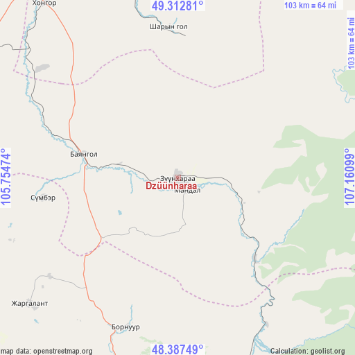
| Upper-left | 49.31281°, | 105.75474° |
| Center: | 48.85229°, | 106.45786° |
| Lower-right: | 48.38749°, | 107.16099° |
| Map W x H: | 102.9×102.9 km | = 63.9×63.9mi |
| max Lat: | 51.50725° ⇑26.1% North |
| Dzüünharaa: | 48.85229° |
| min Lat: | ⇓73.9% South 42.84199° |
| min Long | Dzüünharaa | max Long |
| 89.14358° | 106.45786° | 118.51014° |
| W 74.5%⇐ | ⇒25.5% E |
Elevation
Elevation of Dzüünharaa is 867 m = 2844 ft, and this is 549.5 m = 1803 ft below average elevation for this country.
| Max E: |
2800 m = 9186 ft | 90.8% |
| Avg. | 1416.5 m = 4647 ft | |
| Dzüünharaa | 867 m = 2844 ft | |
Min E: |
619 m = 2031 ft | 9.2% |
See also: Mongolia elevation on elevation.city.
Geographical zone
Dzüünharaa is located in North temperate zone (between Tropic of Cancer and the Arctic Circle). Distance of this North polar circle is 1969.3 km =1223.7 mi to North.| Distance of | km | miles | from Dzüünharaa |
|---|---|---|---|
| North Pole | 4575.2 | 2842.9 | to North |
| Arctic Circle | 1969.3 | 1223.7 | to North |
| Tropic Cancer | 2825.9 | 1755.9 | to South |
| Equator | 5431.9 | 3375.2 | to South |


Nearby cities:
15 places around Dzüünharaa: (largest is in red/bold)
• Bornuur
45.1 km =28 mi,  198°
198°
• Bugant
86.1 km =53.5 mi,  19°
19°
• Darhan
80.6 km =50.1 mi,  331°
331°
• Dzüünkharaa
31.6 km =19.6 mi,  140°
140°
• Enhtal
90.4 km =56.2 mi,  299°
299°
• Hongor
58.6 km =36.4 mi,  315°
315°
• Hushaat
94.5 km =58.7 mi, 319°
• Ihsüüj
70.7 km =43.9 mi,  189°
189°
• Jargalant
56.9 km =35.4 mi,  229°
229°
• Javhlant
39.5 km =24.5 mi,  261°
261°
• Mandal
57.5 km =35.7 mi,  158°
158°
• Nart
84.5 km =52.5 mi,  292°
292°
• Nomgon
69.5 km =43.2 mi, 303°
• Orgil
94.7 km =58.8 mi,  242°
242°
• Sharïngol
42.9 km =26.7 mi,  357°
357°
Sources, notices
• [Note1] Compared only with cities in Mongolia existing in our database
• [Src1] Map data: © OpenStreetMap contributors (CC-BY-SA)
• [Src2] Other city data from geonames.org with taken over terms of usage.
• [Src3] Geographical zone / Annual Mean Temperature by Robert A. Rohde @ Wikipedia
