Bürenhayrhan geodata
Bürenhayrhan (Hovd) is a seat of a second-order administrative division; located in Mongolia in Asia/Hovd (GMT+7) time zone. In our database, there are 33 cities with bigger population. Compared to other cities in Mongolia, 78.2% of cities are located further ↑North; 95.1% of cities are located further →East and 69% of cities have higher elevation than Bürenhayrhan. Note1


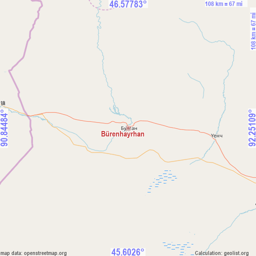
Bürenhayrhan GPS coordinates[2]
46° 5' 32.532" North, 91° 32' 52.656" East
| Map corner | latitude | longitude |
|---|---|---|
| Upper-left | 46.57783°, | 90.84484° |
| Center: | 46.09237°, | 91.54796° |
| Lower-right: | 45.6026°, | 92.25109° |
| Map W x H: | 108.4×108.4 km | = 67.4×67.4mi |
| max Lat: | 51.50725° ⇑78.2% North |
| Bürenhayrhan: | 46.09237° |
| min Lat: | ⇓21.8% South 42.84199° |
| min Long | Bürenhayrhan | max Long |
| 89.14358° | 91.54796° | 118.51014° |
| W 4.9%⇐ | ⇒95.1% E |
Elevation
Elevation of Bürenhayrhan is 1183 m = 3881 ft, and this is 233.5 m = 766 ft below average elevation for this country.
| Max E: |
2800 m = 9186 ft | 69% |
| Avg. | 1416.5 m = 4647 ft | |
| Bürenhayrhan | 1183 m = 3881 ft | |
Min E: |
619 m = 2031 ft | 31% |
See also: Mongolia elevation on elevation.city.
Geographical zone
Bürenhayrhan is located in North temperate zone (between Tropic of Cancer and the Arctic Circle). Distance of this North polar circle is 2276.2 km =1414.4 mi to North.| Distance of | km | miles | from Bürenhayrhan |
|---|---|---|---|
| North Pole | 4882.1 | 3033.6 | to North |
| Arctic Circle | 2276.2 | 1414.4 | to North |
| Tropic Cancer | 2519.1 | 1565.3 | to South |
| Equator | 5125 | 3184.5 | to South |


Nearby cities:
15 places around Bürenhayrhan: (largest is in red/bold)
• Altanteel
150.4 km =93.5 mi,  41°
41°
• Altay sumu
65.5 km =40.7 mi,  119°
119°
• Darvi
184 km =114.3 mi,  59°
59°
• Darvi
201.4 km =125.1 mi,  78°
78°
• Duut
158.5 km =98.5 mi,  2°
2°
• Dzüyl
182.9 km =113.6 mi, 82°
• Jargalant
99.2 km =61.6 mi,  339°
339°
• Khovd
212.8 km =132.2 mi, 1°
• Rashaant
193.9 km =120.5 mi, 343°
• Tsenher
101.5 km =63.1 mi,  25°
25°
• Tsetsegnuur
143.5 km =89.2 mi,  66°
66°
• Tögrög
156.8 km =97.4 mi,  19°
19°
• Ulaantolgoy
115.3 km =71.6 mi, 55°
• Urdgol
210.9 km =131 mi, 23°
• Uyenchi Somon
36.5 km =22.7 mi,  97°
97°
Sources, notices
• [Note1] Compared only with cities in Mongolia existing in our database
• [Src1] Map data: © OpenStreetMap contributors (CC-BY-SA)
• [Src2] Other city data from geonames.org with taken over terms of usage.
• [Src3] Geographical zone / Annual Mean Temperature by Robert A. Rohde @ Wikipedia
