Uyenchi Somon geodata
Uyenchi Somon (Hovd) is a seat of a second-order administrative division; located in Mongolia in Asia/Hovd (GMT+7) time zone. In our database, there are 33 cities with bigger population. Compared to other cities in Mongolia, 79.1% of cities are located further ↑North; 92.3% of cities are located further →East and 50.9% of cities have higher elevation than Uyenchi Somon. Note1


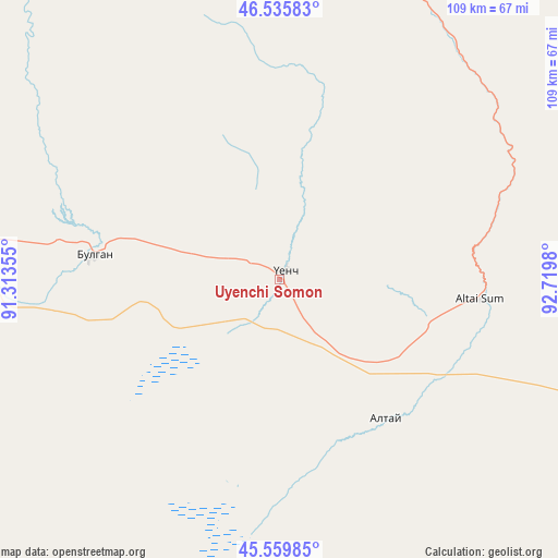
Uyenchi Somon GPS coordinates[2]
46° 3' 0" North, 92° 1' 0.012" East
| Map corner | latitude | longitude |
|---|---|---|
| Upper-left | 46.53583°, | 91.31355° |
| Center: | 46.05°, | 92.01667° |
| Lower-right: | 45.55985°, | 92.7198° |
| Map W x H: | 108.5×108.5 km | = 67.4×67.4mi |
| max Lat: | 51.50725° ⇑79.1% North |
| Uyenchi Somon: | 46.05° |
| min Lat: | ⇓20.9% South 42.84199° |
| min Long | Uyenchi Somon | max Long |
| 89.14358° | 92.01667° | 118.51014° |
| W 7.7%⇐ | ⇒92.3% E |
Elevation
Elevation of Uyenchi Somon is 1378 m = 4521 ft, and this is 38.5 m = 126 ft below average elevation for this country.
| Max E: |
2800 m = 9186 ft | 50.9% |
| Avg. | 1416.5 m = 4647 ft | |
| Uyenchi Somon | 1378 m = 4521 ft | |
Min E: |
619 m = 2031 ft | 49.1% |
See also: Mongolia elevation on elevation.city.
Geographical zone
Uyenchi Somon is located in North temperate zone (between Tropic of Cancer and the Arctic Circle). Distance of this North polar circle is 2280.9 km =1417.3 mi to North.| Distance of | km | miles | from Uyenchi Somon |
|---|---|---|---|
| North Pole | 4886.8 | 3036.5 | to North |
| Arctic Circle | 2280.9 | 1417.3 | to North |
| Tropic Cancer | 2514.4 | 1562.4 | to South |
| Equator | 5120.3 | 3181.6 | to South |


Nearby cities:
15 places around Uyenchi Somon: (largest is in red/bold)
• Altanteel
133.8 km =83.1 mi,  28°
28°
• Altay sumu
34.6 km =21.5 mi,  143°
143°
• Bayangol
190.1 km =118.1 mi,  106°
106°
• Bürenhayrhan
36.5 km =22.7 mi,  277°
277°
• Darvi
157.2 km =97.7 mi,  51°
51°
• Darvi
167.5 km =104.1 mi,  74°
74°
• Duut
165.7 km =103 mi,  349°
349°
• Dzüyl
148.1 km =92 mi,  78°
78°
• Jargalant
120.7 km =75 mi,  323°
323°
• Rashaant
211 km =131.1 mi,  334°
334°
• Tsenher
96.7 km =60.1 mi,  4°
4°
• Tsetsegnuur
113.8 km =70.7 mi,  57°
57°
• Tögrög
153.6 km =95.4 mi,  5°
5°
• Ulaantolgoy
91.8 km =57 mi,  39°
39°
• Urdgol
204 km =126.8 mi, 13°
Sources, notices
• [Note1] Compared only with cities in Mongolia existing in our database
• [Src1] Map data: © OpenStreetMap contributors (CC-BY-SA)
• [Src2] Other city data from geonames.org with taken over terms of usage.
• [Src3] Geographical zone / Annual Mean Temperature by Robert A. Rohde @ Wikipedia
