Altanteel geodata
Altanteel (Hovd) is a seat of a second-order administrative division; located in Mongolia in Asia/Hovd (GMT+7) time zone. In our database, there are 33 cities with bigger population. Compared to other cities in Mongolia, 60.4% of cities are located further ↑North; 89.3% of cities are located further →East and 72.1% of cities have higher elevation than Altanteel. Note1


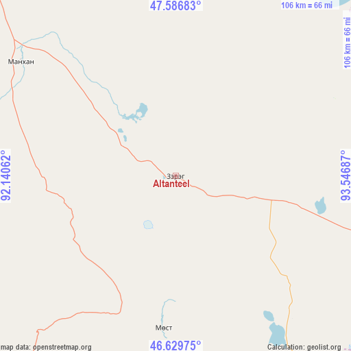
Altanteel GPS coordinates[2]
47° 6' 37.584" North, 92° 50' 37.464" East
| Map corner | latitude | longitude |
|---|---|---|
| Upper-left | 47.58683°, | 92.14062° |
| Center: | 47.11044°, | 92.84374° |
| Lower-right: | 46.62975°, | 93.54687° |
| Map W x H: | 106.4×106.4 km | = 66.1×66.1mi |
| max Lat: | 51.50725° ⇑60.4% North |
| Altanteel: | 47.11044° |
| min Lat: | ⇓39.6% South 42.84199° |
| min Long | Altanteel | max Long |
| 89.14358° | 92.84374° | 118.51014° |
| W 10.7%⇐ | ⇒89.3% E |
Elevation
Elevation of Altanteel is 1142 m = 3747 ft, and this is 274.5 m = 901 ft below average elevation for this country.
| Max E: |
2800 m = 9186 ft | 72.1% |
| Avg. | 1416.5 m = 4647 ft | |
| Altanteel | 1142 m = 3747 ft | |
Min E: |
619 m = 2031 ft | 27.9% |
See also: Mongolia elevation on elevation.city.
Geographical zone
Altanteel is located in North temperate zone (between Tropic of Cancer and the Arctic Circle). Distance of this North polar circle is 2163 km =1344 mi to North.| Distance of | km | miles | from Altanteel |
|---|---|---|---|
| North Pole | 4768.9 | 2963.3 | to North |
| Arctic Circle | 2163 | 1344 | to North |
| Tropic Cancer | 2632.3 | 1635.6 | to South |
| Equator | 5238.2 | 3254.9 | to South |


Nearby cities:
15 places around Altanteel: (largest is in red/bold)
• Bayanhoshuu
142.8 km =88.7 mi,  330°
330°
• Buyant
131.3 km =81.6 mi,  324°
324°
• Darvi
61.7 km =38.3 mi,  108°
108°
• Darvi
121.6 km =75.6 mi,  127°
127°
• Duut
101.8 km =63.3 mi,  296°
296°
• Dzüyl
120.5 km =74.9 mi,  137°
137°
• Jargalant
134.7 km =83.7 mi,  261°
261°
• Khovd
134.3 km =83.5 mi, 317°
• Sayn-Ust
129.8 km =80.7 mi,  77°
77°
• Tsenher
59.2 km =36.8 mi,  248°
248°
• Tsetsegnuur
65.2 km =40.5 mi,  150°
150°
• Tögrög
58.3 km =36.2 mi,  306°
306°
• Ulaantolgoy
47.7 km =29.6 mi,  185°
185°
• Urdgol
81.7 km =50.8 mi,  349°
349°
• Uyenchi Somon
133.8 km =83.1 mi,  208°
208°
Sources, notices
• [Note1] Compared only with cities in Mongolia existing in our database
• [Src1] Map data: © OpenStreetMap contributors (CC-BY-SA)
• [Src2] Other city data from geonames.org with taken over terms of usage.
• [Src3] Geographical zone / Annual Mean Temperature by Robert A. Rohde @ Wikipedia
