Bayan geodata
Bayan (Hövsgöl) is a seat of a second-order administrative division; located in Mongolia in Asia/Ulaanbaatar (GMT+8) time zone. In our database, there are 33 cities with bigger population. Compared to other cities in Mongolia, 85.6% of cities are located further ↓South; 67.2% of cities are located further →East and 77.3% of cities have lower elevation than Bayan. Note1


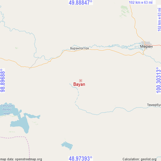
Bayan GPS coordinates[2]
49° 25' 59.988" North, 99° 36' 0" East
| Map corner | latitude | longitude |
|---|---|---|
| Upper-left | 49.88847°, | 98.89688° |
| Center: | 49.43333°, | 99.6° |
| Lower-right: | 48.97393°, | 100.30313° |
| Map W x H: | 101.7×101.7 km | = 63.2×63.2mi |
| max Lat: | 51.50725° ⇑14.4% North |
| Bayan: | 49.43333° |
| min Lat: | ⇓85.6% South 42.84199° |
| min Long | Bayan | max Long |
| 89.14358° | 99.6° | 118.51014° |
| W 32.8%⇐ | ⇒67.2% E |
Elevation
Elevation of Bayan is 1749 m = 5738 ft, and this is 332.5 m = 1091 ft above average elevation for this country.
| Max E: |
2800 m = 9186 ft | 22.7% |
| Bayan | 1749 m 5738 ft | |
| Avg. | 1416.5 m = 4647 ft | |
Min E: |
619 m = 2031 ft | 77.3% |
See also: Mongolia elevation on elevation.city.
Geographical zone
Bayan is located in North temperate zone (between Tropic of Cancer and the Arctic Circle). Distance of this North polar circle is 1904.7 km =1183.5 mi to North.| Distance of | km | miles | from Bayan |
|---|---|---|---|
| North Pole | 4510.6 | 2802.8 | to North |
| Arctic Circle | 1904.7 | 1183.5 | to North |
| Tropic Cancer | 2890.6 | 1796.1 | to South |
| Equator | 5496.5 | 3415.4 | to South |


Nearby cities:
15 places around Bayan: (largest is in red/bold)
• Altraga
94.4 km =58.7 mi,  331°
331°
• Bayan-Uhaa
98.9 km =61.5 mi,  216°
216°
• Bayantsagaan
115 km =71.5 mi,  132°
132°
• Bulag
87.8 km =54.6 mi,  57°
57°
• Erdenet
54.1 km =33.6 mi,  184°
184°
• Hujirt
134.1 km =83.3 mi,  117°
117°
• Ider
76.1 km =47.3 mi,  164°
164°
• Jargalant
50 km =31.1 mi,  107°
107°
• Mandal
53.3 km =33.1 mi,  346°
346°
• Manhan
82.9 km =51.5 mi,  22°
22°
• Murun-kuren
46.3 km =28.8 mi, 61°
• Orgil
95.8 km =59.5 mi,  190°
190°
• Sharga
70.6 km =43.9 mi,  305°
305°
• Tosontsengel
121.8 km =75.7 mi,  231°
231°
• Tsengel
93.3 km =58 mi,  86°
86°
Sources, notices
• [Note1] Compared only with cities in Mongolia existing in our database
• [Src1] Map data: © OpenStreetMap contributors (CC-BY-SA)
• [Src2] Other city data from geonames.org with taken over terms of usage.
• [Src3] Geographical zone / Annual Mean Temperature by Robert A. Rohde @ Wikipedia
