Orgil geodata
Orgil (Hövsgöl) is a seat of a second-order administrative division; located in Mongolia in Asia/Ulaanbaatar (GMT+8) time zone. In our database, there are 33 cities with bigger population. Compared to other cities in Mongolia, 68.4% of cities are located further ↓South; 69% of cities are located further →East and 66.3% of cities have lower elevation than Orgil. Note1


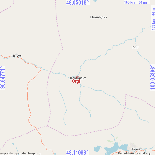
Orgil GPS coordinates[2]
48° 35' 13.992" North, 99° 21' 2.988" East
| Map corner | latitude | longitude |
|---|---|---|
| Upper-left | 49.05018°, | 98.64771° |
| Center: | 48.58722°, | 99.35083° |
| Lower-right: | 48.11998°, | 100.05396° |
| Map W x H: | 103.4×103.4 km | = 64.2×64.2mi |
| max Lat: | 51.50725° ⇑31.6% North |
| Orgil: | 48.58722° |
| min Lat: | ⇓68.4% South 42.84199° |
| min Long | Orgil | max Long |
| 89.14358° | 99.35083° | 118.51014° |
| W 31%⇐ | ⇒69% E |
Elevation
Elevation of Orgil is 1551 m = 5089 ft, and this is 134.5 m = 441 ft above average elevation for this country.
| Max E: |
2800 m = 9186 ft | 33.7% |
| Orgil | 1551 m 5089 ft | |
| Avg. | 1416.5 m = 4647 ft | |
Min E: |
619 m = 2031 ft | 66.3% |
See also: Mongolia elevation on elevation.city.
Geographical zone
Orgil is located in North temperate zone (between Tropic of Cancer and the Arctic Circle). Distance of this North polar circle is 1998.8 km =1242 mi to North.| Distance of | km | miles | from Orgil |
|---|---|---|---|
| North Pole | 4604.7 | 2861.2 | to North |
| Arctic Circle | 1998.8 | 1242 | to North |
| Tropic Cancer | 2796.5 | 1737.7 | to South |
| Equator | 5402.4 | 3356.9 | to South |


Nearby cities:
15 places around Orgil: (largest is in red/bold)
• Bayan
95.8 km =59.5 mi,  10°
10°
• Bayan-Uhaa
43.6 km =27.1 mi,  289°
289°
• Bayantsagaan
104.7 km =65.1 mi,  81°
81°
• Erdenet
42.4 km =26.3 mi,  18°
18°
• Horgo
61.3 km =38.1 mi,  140°
140°
• Hunt
80.6 km =50.1 mi,  173°
173°
• Ider
43.6 km =27.1 mi,  61°
61°
• Jargalant
102.9 km =63.9 mi,  40°
40°
• Jargalant
133.7 km =83.1 mi,  151°
151°
• Murun-kuren
130.5 km =81.1 mi,  26°
26°
• Sharga
140.7 km =87.4 mi,  343°
343°
• Teel
104.7 km =65.1 mi,  125°
125°
• Telmin Suma
127.5 km =79.2 mi,  272°
272°
• Tosontsengel
80.6 km =50.1 mi,  283°
283°
• Tsahir
67.4 km =41.9 mi,  213°
213°
Sources, notices
• [Note1] Compared only with cities in Mongolia existing in our database
• [Src1] Map data: © OpenStreetMap contributors (CC-BY-SA)
• [Src2] Other city data from geonames.org with taken over terms of usage.
• [Src3] Geographical zone / Annual Mean Temperature by Robert A. Rohde @ Wikipedia
