Fonadhoo geodata
Fonadhoo (Laamu) is a seat of a first-order administrative division; located in Maldives in Indian/Maldives (GMT+5) time zone. With population of 1,773 people, there are 16 cities with bigger population in this country. Compared to other cities in Maldives, 78.6% of cities are located further ↑North; 85.7% of cities are located further ←West and 71.4% of cities have higher elevation than Fonadhoo. Note1


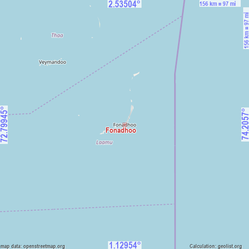
Fonadhoo GPS coordinates[2]
1° 49' 56.748" North, 73° 30' 9.252" East
| Map corner | latitude | longitude |
|---|---|---|
| Upper-left | 2.53504°, | 72.79945° |
| Center: | 1.83243°, | 73.50257° |
| Lower-right: | 1.12954°, | 74.2057° |
| Map W x H: | 156.3×156.3 km | = 97.1×97.1mi |
| max Lat: | 6.88744° ⇑78.6% North |
| Fonadhoo: | 1.83243° |
| min Lat: | ⇓21.4% South -0.6° |
| min Long | Fonadhoo | max Long |
| 72.89437° | 73.50257° | 73.56667° |
| W 85.7%⇐ | ⇒14.3% E |
Elevation
Elevation of Fonadhoo is 7 m = 23 ft, and this is 0.3 m = 1 ft below average elevation for this country.
| Max E: |
12 m = 39 ft | 71.4% |
| Avg. | 7.3 m = 24 ft | |
| Fonadhoo | 7 m = 23 ft | |
Min E: |
-1 m = -3 ft | 28.6% |
See also: Maldives elevation on elevation.city.
Geographical zone
Fonadhoo is located in North Torrid zone (between Equator and Tropic of Cancer). Distance of Equator is 203.7 km =126.6 mi to South.| Distance of | km | miles | from Fonadhoo |
|---|---|---|---|
| North Pole | 9803.3 | 6091.5 | to North |
| Arctic Circle | 7197.4 | 4472.3 | to North |
| Tropic Cancer | 2402.2 | 1492.7 | to North |
| Equator | 203.7 | 126.6 | to South |


Nearby cities:
15 places around Fonadhoo: (largest is in red/bold)
• Buruni
91.9 km =57.1 mi,  331°
331°
• Diyamigili
59.3 km =36.8 mi,  342°
342°
• Felidhoo
182.3 km =113.3 mi,  1°
1°
• Guraidhoo
58.4 km =36.3 mi, 339°
• Guraidhoo
230 km =142.9 mi,  358°
358°
• Hithadhoo
13.3 km =8.3 mi,  252°
252°
• Kudahuvadhoo
115.1 km =71.5 mi,  324°
324°
• Maafushi
234.6 km =145.8 mi, 359°
• Madifushi
60.5 km =37.6 mi, 344°
• Mahibadhoo
222.1 km =138 mi, 344°
• Muli
120.8 km =75.1 mi, 3°
• Thinadhoo
155.2 km =96.4 mi,  201°
201°
• Veymandoo
60.1 km =37.3 mi,  311°
311°
• Viligili
119.6 km =74.3 mi,  183°
183°
• Vilufushi
77.6 km =48.2 mi, 343°
Sources, notices
• [Note1] Compared only with cities in Maldives existing in our database
• [Src1] Map data: © OpenStreetMap contributors (CC-BY-SA)
• [Src2] Other city data from geonames.org with taken over terms of usage.
• [Src3] Geographical zone / Annual Mean Temperature by Robert A. Rohde @ Wikipedia
