Makera geodata
Makera (Kaduna) is a seat of a second-order administrative division; located in Nigeria in Africa/Lagos (GMT+1) time zone. In our database, there are 451 cities with bigger population. Compared to other cities in Nigeria, 68.7% of cities are located further ↓South; 51.7% of cities are located further ←West and 93.1% of cities have lower elevation than Makera. Note1


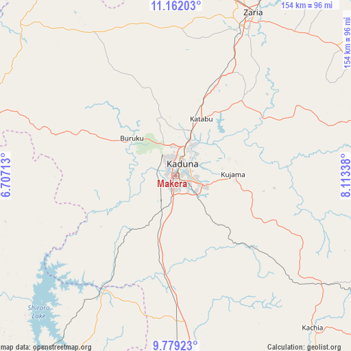
Makera GPS coordinates[2]
10° 28' 17.04" North, 7° 24' 36.936" East
| Map corner | latitude | longitude |
|---|---|---|
| Upper-left | 11.16203°, | 6.70713° |
| Center: | 10.4714°, | 7.41026° |
| Lower-right: | 9.77923°, | 8.11338° |
| Map W x H: | 153.8×153.8 km | = 95.6×95.6mi |
| max Lat: | 13.7543° ⇑31.3% North |
| Makera: | 10.4714° |
| min Lat: | ⇓68.7% South 4.31231° |
| min Long | Makera | max Long |
| 2.73333° | 7.41026° | 14.46552° |
| W 51.7%⇐ | ⇒48.3% E |
Elevation
Elevation of Makera is 604 m = 1982 ft, and this is 307.5 m = 1009 ft above average elevation for this country.
| Max E: |
1599 m = 5246 ft | 6.9% |
| Makera | 604 m 1982 ft | |
| Avg. | 296.5 m = 973 ft | |
Min E: |
2 m = 7 ft | 93.1% |
See also: Nigeria elevation on elevation.city.
Geographical zone
Makera is located in North Torrid zone (between Equator and Tropic of Cancer). Distance of Equator is 1164.3 km =723.5 mi to South.| Distance of | km | miles | from Makera |
|---|---|---|---|
| North Pole | 8842.8 | 5494.7 | to North |
| Arctic Circle | 6236.9 | 3875.4 | to North |
| Tropic Cancer | 1441.6 | 895.8 | to North |
| Equator | 1164.3 | 723.5 | to South |


Nearby cities:
15 places around Makera: (largest is in red/bold)
• Dutsen Wai
95.9 km =59.6 mi,  63°
63°
• Giwa
94 km =58.4 mi,  2°
2°
• Hunkuyi
92.2 km =57.3 mi,  16°
16°
• Igabi
49.9 km =31 mi,  41°
41°
• Kachia
89.2 km =55.4 mi,  138°
138°
• Kaduna
6.9 km =4.3 mi,  27°
27°
• Kajuru
34.3 km =21.3 mi,  118°
118°
• Kauru
81.8 km =50.8 mi,  81°
81°
• Kujama
25 km =15.5 mi,  93°
93°
• Maigana
84.5 km =52.5 mi, 43°
• Sabuwa
84.2 km =52.3 mi,  337°
337°
• Sarkin Pawa
59.8 km =37.2 mi,  213°
213°
• Soba
90.6 km =56.3 mi,  51°
51°
• Sofo-Birnin-Gwari
91.6 km =56.9 mi,  311°
311°
• Zaria
78.9 km =49 mi, 25°
Sources, notices
• [Note1] Compared only with cities in Nigeria existing in our database
• [Src1] Map data: © OpenStreetMap contributors (CC-BY-SA)
• [Src2] Other city data from geonames.org with taken over terms of usage.
• [Src3] Geographical zone / Annual Mean Temperature by Robert A. Rohde @ Wikipedia
