Zuid-Scharwoude geodata
Zuid-Scharwoude (North Holland) is a populated place; located in Netherlands in Europe/Amsterdam (GMT+2) time zone. With population of 6,165 people, there are 401 cities with bigger population in this country. Compared to other cities in Netherlands, 76.2% of cities are located further ↓South; 79.3% of cities are located further →East and 74.9% of cities have higher elevation than Zuid-Scharwoude. Note1


Zuid-Scharwoude GPS coordinates[2]
52° 41' 12.012" North, 4° 48' 29.988" East
| Map corner | latitude | longitude |
|---|---|---|
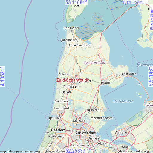
| Upper-left | 53.11081°, | 4.10521° |
| Center: | 52.68667°, | 4.80833° |
| Lower-right: | 52.25837°, | 5.51146° |
| Map W x H: | 94.8×94.8 km | = 58.9×58.9mi |
| max Lat: | 53.48025° ⇑23.8% North |
| Zuid-Scharwoude: | 52.68667° |
| min Lat: | ⇓76.2% South 50.76917° |
| min Long | Zuid-Scharwoude | max Long |
| 3.38611° | 4.80833° | 7.16528° |
| W 20.7%⇐ | ⇒79.3% E |
Elevation
Elevation of Zuid-Scharwoude is 2 m = 7 ft, and this is 13 m = 43 ft below average elevation for this country.
| Max E: |
203 m = 666 ft | 74.9% |
| Avg. | 15 m = 49 ft | |
| Zuid-Scharwoude | 2 m = 7 ft | |
Min E: |
-6 m = -20 ft | 25.1% |
See also: Netherlands elevation on elevation.city.
Geographical zone
Zuid-Scharwoude is located in North temperate zone (between Tropic of Cancer and the Arctic Circle). Distance of this North polar circle is 1543 km =958.8 mi to North.| Distance of | km | miles | from Zuid-Scharwoude |
|---|---|---|---|
| North Pole | 4148.9 | 2578 | to North |
| Arctic Circle | 1543 | 958.8 | to North |
| Tropic Cancer | 3252.3 | 2020.9 | to South |
| Equator | 5858.2 | 3640.1 | to South |


Nearby cities:
15 places around Zuid-Scharwoude: (largest is in red/bold)
• Aagtdorp
7 km =4.3 mi,  273°
273°
• Alkmaar
7.3 km =4.5 mi,  213°
213°
• Bergen
7.3 km =4.5 mi,  254°
254°
• Broek op Langedijk
1.4 km =0.9 mi,  187°
187°
• De Noord
3.7 km =2.3 mi,  51°
51°
• Dirkshorn
7.4 km =4.6 mi,  342°
342°
• Harenkarspel
5.7 km =3.5 mi, 338°
• Heerhugowaard
3.2 km =2 mi,  121°
121°
• Hensbroek
6 km =3.7 mi, 121°
• Noord-Scharwoude
1.3 km =0.8 mi,  8°
8°
• Obdam
6.8 km =4.2 mi,  100°
100°
• Oterleek
5.8 km =3.6 mi,  162°
162°
• Oudkarspel
3.2 km =2 mi,  356°
356°
• Sint Pancras
3.4 km =2.1 mi, 209°
• Waarland
4.7 km =2.9 mi,  19°
19°
Sources, notices
• [Note1] Compared only with cities in Netherlands existing in our database
• [Src1] Map data: © OpenStreetMap contributors (CC-BY-SA)
• [Src2] Other city data from geonames.org with taken over terms of usage.
• [Src3] Geographical zone / Annual Mean Temperature by Robert A. Rohde @ Wikipedia
