Prestfoss geodata
Prestfoss (Buskerud) is a seat of a second-order administrative division; located in Norway in Europe/Oslo (GMT+2) time zone. With population of 465 people, there are 464 cities with bigger population in this country. Compared to other cities in Norway, 63.8% of cities are located further ↑North; 55.1% of cities are located further →East and 69.5% of cities have lower elevation than Prestfoss. Note1


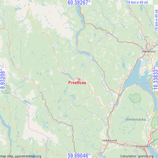
Prestfoss GPS coordinates[2]
60° 2' 36.348" North, 9° 38' 6.72" East
| Map corner | latitude | longitude |
|---|---|---|
| Upper-left | 60.39267°, | 8.93208° |
| Center: | 60.04343°, | 9.6352° |
| Lower-right: | 59.69046°, | 10.33833° |
| Map W x H: | 78.1×78.1 km | = 48.5×48.5mi |
| max Lat: | 71.04137° ⇑63.8% North |
| Prestfoss: | 60.04343° |
| min Lat: | ⇓36.2% South 58.0274° |
| min Long | Prestfoss | max Long |
| 4.71485° | 9.6352° | 31.11066° |
| W 44.9%⇐ | ⇒55.1% E |
Elevation
Elevation of Prestfoss is 120 m = 394 ft, and this is 15.8 m = 52 ft above average elevation for this country.
| Max E: |
897 m = 2943 ft | 30.5% |
| Prestfoss | 120 m 394 ft | |
| Avg. | 104.2 m = 342 ft | |
Min E: |
1 m = 3 ft | 69.5% |
See also: Norway elevation on elevation.city.
Geographical zone
Prestfoss is located in North temperate zone (between Tropic of Cancer and the Arctic Circle). Distance of this North polar circle is 725 km =450.5 mi to North.| Distance of | km | miles | from Prestfoss |
|---|---|---|---|
| North Pole | 3330.9 | 2069.7 | to North |
| Arctic Circle | 725 | 450.5 | to North |
| Tropic Cancer | 4070.3 | 2529.2 | to South |
| Equator | 6676.2 | 4148.4 | to South |


Nearby cities:
15 places around Prestfoss: (largest is in red/bold)
• Hallingby
39.6 km =24.6 mi,  50°
50°
• Hokksund
34 km =21.1 mi,  153°
153°
• Hønefoss
37.1 km =23.1 mi,  68°
68°
• Kongsberg
41.7 km =25.9 mi,  178°
178°
• Lampeland
23.4 km =14.5 mi,  187°
187°
• Mjøndalen
39.1 km =24.3 mi, 146°
• Noresund
15.2 km =9.4 mi,  357°
357°
• Rollag
19.9 km =12.4 mi,  250°
250°
• Sokna
27.1 km =16.8 mi,  36°
36°
• Sundvollen
37.4 km =23.2 mi,  86°
86°
• Sylling
40.1 km =24.9 mi,  114°
114°
• Tranby
43.6 km =27.1 mi,  126°
126°
• Tyristrand
26 km =16.2 mi,  79°
79°
• Vik
35.9 km =22.3 mi, 84°
• Vikersund
21.5 km =13.4 mi, 112°
Sources, notices
• [Note1] Compared only with cities in Norway existing in our database
• [Src1] Map data: © OpenStreetMap contributors (CC-BY-SA)
• [Src2] Other city data from geonames.org with taken over terms of usage.
• [Src3] Geographical zone / Annual Mean Temperature by Robert A. Rohde @ Wikipedia
