Bodø geodata
Bodø (Nordland) is a seat of a first-order administrative division; located in Norway in Europe/Oslo (GMT+2) time zone. With population of 34,073 people, there are 18 cities with bigger population in this country. Compared to other cities in Norway, 87.3% of cities are located further ↓South; 88.1% of cities are located further ←West and 64.2% of cities have higher elevation than Bodø. Note1


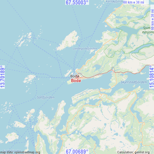
Bodø GPS coordinates[2]
67° 16' 48" North, 14° 24' 18.036" East
| Map corner | latitude | longitude |
|---|---|---|
| Upper-left | 67.55003°, | 13.70189° |
| Center: | 67.28°, | 14.40501° |
| Lower-right: | 67.00689°, | 15.10814° |
| Map W x H: | 60.4×60.4 km | = 37.5×37.5mi |
| max Lat: | 71.04137° ⇑12.7% North |
| Bodø: | 67.28° |
| min Lat: | ⇓87.3% South 58.0274° |
| min Long | Bodø | max Long |
| 4.71485° | 14.40501° | 31.11066° |
| W 88.1%⇐ | ⇒11.9% E |
Elevation
Elevation of Bodø is 22 m = 72 ft, and this is 82.2 m = 270 ft below average elevation for this country.
| Max E: |
897 m = 2943 ft | 64.2% |
| Avg. | 104.2 m = 342 ft | |
| Bodø | 22 m = 72 ft | |
Min E: |
1 m = 3 ft | 35.8% |
See also: Norway elevation on elevation.city.
Geographical zone
Bodø is located in North Frigid zone (between North Pole and Arctic Circle). Distance of this North polar circle is 79.7 km =49.5 mi to South.| Distance of | km | miles | from Bodø |
|---|---|---|---|
| North Pole | 2526.2 | 1569.7 | to North |
| Arctic Circle | 79.7 | 49.5 | to South |
| Tropic Cancer | 4874.9 | 3029.1 | to South |
| Equator | 7480.8 | 4648.4 | to South |


Nearby cities:
15 places around Bodø: (largest is in red/bold)
• Ballstad
95.5 km =59.3 mi,  337°
337°
• Fauske
42.5 km =26.4 mi,  93°
93°
• Glomfjord
55.3 km =34.4 mi,  201°
201°
• Inndyr
31.9 km =19.8 mi,  210°
210°
• Leinesfjorden
60.9 km =37.8 mi,  25°
25°
• Løding
14.5 km =9 mi,  80°
80°
• Løpsmarka
4.2 km =2.6 mi, 27°
• Moldjord
31.3 km =19.4 mi,  166°
166°
• Reine
91.5 km =56.9 mi,  322°
322°
• Rognan
47 km =29.2 mi,  115°
115°
• Stamsund
97.4 km =60.5 mi,  346°
346°
• Straumen
52 km =32.3 mi, 81°
• Sørland
84.4 km =52.4 mi,  300°
300°
• Vågaholmen
79.5 km =49.4 mi,  217°
217°
• Ørnes
54.8 km =34.1 mi, 213°
Sources, notices
• [Note1] Compared only with cities in Norway existing in our database
• [Src1] Map data: © OpenStreetMap contributors (CC-BY-SA)
• [Src2] Other city data from geonames.org with taken over terms of usage.
• [Src3] Geographical zone / Annual Mean Temperature by Robert A. Rohde @ Wikipedia
