Tretten geodata
Tretten (Oppland) is a seat of a second-order administrative division; located in Norway in Europe/Oslo (GMT+2) time zone. With population of 859 people, there are 344 cities with bigger population in this country. Compared to other cities in Norway, 59.2% of cities are located further ↓South; 54.3% of cities are located further ←West and 90.8% of cities have lower elevation than Tretten. Note1


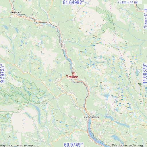
Tretten GPS coordinates[2]
61° 18' 51.228" North, 10° 18' 2.376" East
| Map corner | latitude | longitude |
|---|---|---|
| Upper-left | 61.64992°, | 9.59753° |
| Center: | 61.31423°, | 10.30066° |
| Lower-right: | 60.9749°, | 11.00379° |
| Map W x H: | 75.1×75.1 km | = 46.7×46.7mi |
| max Lat: | 71.04137° ⇑40.8% North |
| Tretten: | 61.31423° |
| min Lat: | ⇓59.2% South 58.0274° |
| min Long | Tretten | max Long |
| 4.71485° | 10.30066° | 31.11066° |
| W 54.3%⇐ | ⇒45.7% E |
Elevation
Elevation of Tretten is 300 m = 984 ft, and this is 195.8 m = 642 ft above average elevation for this country.
| Max E: |
897 m = 2943 ft | 9.2% |
| Tretten | 300 m 984 ft | |
| Avg. | 104.2 m = 342 ft | |
Min E: |
1 m = 3 ft | 90.8% |
See also: Norway elevation on elevation.city.
Geographical zone
Tretten is located in North temperate zone (between Tropic of Cancer and the Arctic Circle). Distance of this North polar circle is 583.7 km =362.7 mi to North.| Distance of | km | miles | from Tretten |
|---|---|---|---|
| North Pole | 3189.6 | 1981.9 | to North |
| Arctic Circle | 583.7 | 362.7 | to North |
| Tropic Cancer | 4211.6 | 2617 | to South |
| Equator | 6817.5 | 4236.2 | to South |


Nearby cities:
15 places around Tretten: (largest is in red/bold)
• Bruflat
59.2 km =36.8 mi,  216°
216°
• Brumunddal
59.2 km =36.8 mi,  144°
144°
• Dokka
54.7 km =34 mi,  192°
192°
• Follebu
11 km =6.8 mi,  184°
184°
• Forset
15 km =9.3 mi,  213°
213°
• Hundorp
32.9 km =20.4 mi,  324°
324°
• Koppang
48.9 km =30.4 mi,  54°
54°
• Kvam
50.8 km =31.6 mi, 320°
• Lillehammer
23.8 km =14.8 mi,  158°
158°
• Moelv
47.5 km =29.5 mi,  153°
153°
• Rena
60.8 km =37.8 mi,  109°
109°
• Ringebu
25.5 km =15.8 mi,  340°
340°
• Segalstad
9.7 km =6 mi,  201°
201°
• Segalstad bru
10.4 km =6.5 mi, 203°
• Vinstra
42.7 km =26.5 mi, 316°
Sources, notices
• [Note1] Compared only with cities in Norway existing in our database
• [Src1] Map data: © OpenStreetMap contributors (CC-BY-SA)
• [Src2] Other city data from geonames.org with taken over terms of usage.
• [Src3] Geographical zone / Annual Mean Temperature by Robert A. Rohde @ Wikipedia
