Follebu geodata
Follebu (Oppland) is a populated place; located in Norway in Europe/Oslo (GMT+2) time zone. With population of 959 people, there are 323 cities with bigger population in this country. Compared to other cities in Norway, 57.9% of cities are located further ↓South; 53.5% of cities are located further ←West and 89.4% of cities have lower elevation than Follebu. Note1


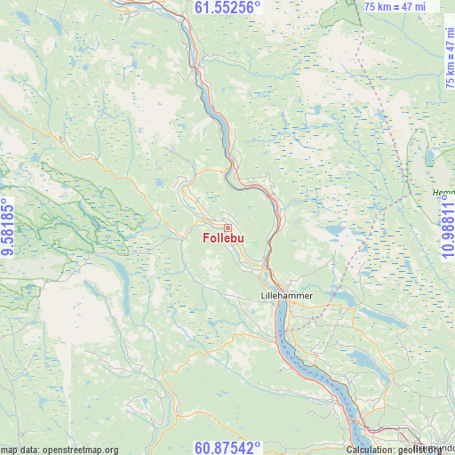
Follebu GPS coordinates[2]
61° 12' 56.916" North, 10° 17' 5.928" East
| Map corner | latitude | longitude |
|---|---|---|
| Upper-left | 61.55256°, | 9.58185° |
| Center: | 61.21581°, | 10.28498° |
| Lower-right: | 60.87542°, | 10.98811° |
| Map W x H: | 75.3×75.3 km | = 46.8×46.8mi |
| max Lat: | 71.04137° ⇑42.1% North |
| Follebu: | 61.21581° |
| min Lat: | ⇓57.9% South 58.0274° |
| min Long | Follebu | max Long |
| 4.71485° | 10.28498° | 31.11066° |
| W 53.5%⇐ | ⇒46.5% E |
Elevation
Elevation of Follebu is 270 m = 886 ft, and this is 165.8 m = 544 ft above average elevation for this country.
| Max E: |
897 m = 2943 ft | 10.6% |
| Follebu | 270 m 886 ft | |
| Avg. | 104.2 m = 342 ft | |
Min E: |
1 m = 3 ft | 89.4% |
See also: Norway elevation on elevation.city.
Geographical zone
Follebu is located in North temperate zone (between Tropic of Cancer and the Arctic Circle). Distance of this North polar circle is 594.6 km =369.5 mi to North.| Distance of | km | miles | from Follebu |
|---|---|---|---|
| North Pole | 3200.5 | 1988.7 | to North |
| Arctic Circle | 594.6 | 369.5 | to North |
| Tropic Cancer | 4200.6 | 2610.1 | to South |
| Equator | 6806.6 | 4229.4 | to South |


Nearby cities:
15 places around Follebu: (largest is in red/bold)
• Aurdal
56.9 km =35.4 mi,  235°
235°
• Bruflat
50.3 km =31.3 mi,  223°
223°
• Brumunddal
51.3 km =31.9 mi,  136°
136°
• Dokka
43.8 km =27.2 mi,  195°
195°
• Forset
7.7 km =4.8 mi,  258°
258°
• Gjøvik
51.6 km =32.1 mi,  154°
154°
• Hundorp
42 km =26.1 mi,  334°
334°
• Koppang
56.7 km =35.2 mi,  45°
45°
• Lillehammer
14.8 km =9.2 mi, 139°
• Moelv
38.5 km =23.9 mi, 144°
• Ringebu
35.8 km =22.2 mi,  347°
347°
• Segalstad
3.4 km =2.1 mi,  305°
305°
• Segalstad bru
3.6 km =2.2 mi,  292°
292°
• Tretten
11 km =6.8 mi,  4°
4°
• Vinstra
50.8 km =31.6 mi, 326°
Sources, notices
• [Note1] Compared only with cities in Norway existing in our database
• [Src1] Map data: © OpenStreetMap contributors (CC-BY-SA)
• [Src2] Other city data from geonames.org with taken over terms of usage.
• [Src3] Geographical zone / Annual Mean Temperature by Robert A. Rohde @ Wikipedia
