Bryne geodata
Bryne (Rogaland) is a seat of a second-order administrative division; located in Norway in Europe/Oslo (GMT+2) time zone. With population of 8,006 people, there are 60 cities with bigger population in this country. Compared to other cities in Norway, 93% of cities are located further ↑North; 88.1% of cities are located further →East and 55.9% of cities have higher elevation than Bryne. Note1


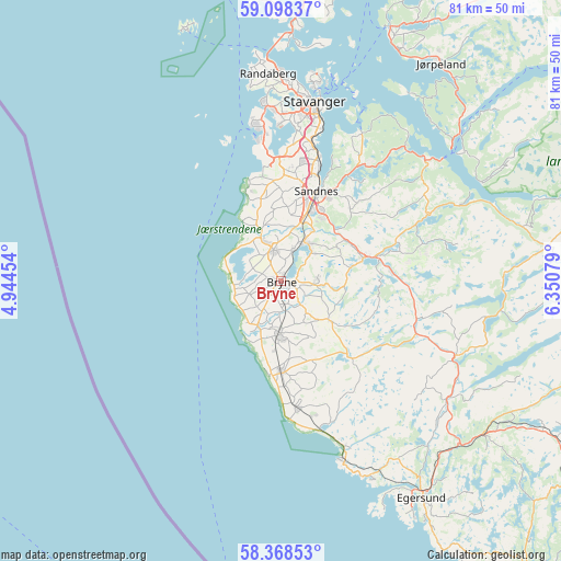
Bryne GPS coordinates[2]
58° 44' 7.296" North, 5° 38' 51.576" East
| Map corner | latitude | longitude |
|---|---|---|
| Upper-left | 59.09837°, | 4.94454° |
| Center: | 58.73536°, | 5.64766° |
| Lower-right: | 58.36853°, | 6.35079° |
| Map W x H: | 81.2×81.1 km | = 50.5×50.4mi |
| max Lat: | 71.04137° ⇑93% North |
| Bryne: | 58.73536° |
| min Lat: | ⇓7% South 58.0274° |
| min Long | Bryne | max Long |
| 4.71485° | 5.64766° | 31.11066° |
| W 11.9%⇐ | ⇒88.1% E |
Elevation
Elevation of Bryne is 33 m = 108 ft, and this is 71.2 m = 234 ft below average elevation for this country.
| Max E: |
897 m = 2943 ft | 55.9% |
| Avg. | 104.2 m = 342 ft | |
| Bryne | 33 m = 108 ft | |
Min E: |
1 m = 3 ft | 44.1% |
See also: Norway elevation on elevation.city.
Geographical zone
Bryne is located in North temperate zone (between Tropic of Cancer and the Arctic Circle). Distance of this North polar circle is 870.4 km =540.8 mi to North.| Distance of | km | miles | from Bryne |
|---|---|---|---|
| North Pole | 3476.3 | 2160.1 | to North |
| Arctic Circle | 870.4 | 540.8 | to North |
| Tropic Cancer | 3924.8 | 2438.8 | to South |
| Equator | 6530.8 | 4058 | to South |


Nearby cities:
15 places around Bryne: (largest is in red/bold)
• Hellvik
31.6 km =19.6 mi,  154°
154°
• Hommersåk
24.2 km =15 mi,  28°
28°
• Kleppe
4.4 km =2.7 mi,  346°
346°
• Lyefjell
5.1 km =3.2 mi,  89°
89°
• Nærbø
7.8 km =4.8 mi,  184°
184°
• Oltedal
24.7 km =15.3 mi,  65°
65°
• Randaberg
29.4 km =18.3 mi,  356°
356°
• Sandnes
14 km =8.7 mi,  21°
21°
• Sola
17 km =10.6 mi,  1°
1°
• Stavanger
26.6 km =16.5 mi,  10°
10°
• Tananger
22.7 km =14.1 mi, 349°
• Varhaug
13 km =8.1 mi, 177°
• Vigrestad
18.4 km =11.4 mi,  173°
173°
• Vikeså
27.8 km =17.3 mi,  112°
112°
• Ålgård
12.2 km =7.6 mi, 74°
Sources, notices
• [Note1] Compared only with cities in Norway existing in our database
• [Src1] Map data: © OpenStreetMap contributors (CC-BY-SA)
• [Src2] Other city data from geonames.org with taken over terms of usage.
• [Src3] Geographical zone / Annual Mean Temperature by Robert A. Rohde @ Wikipedia
