Lyefjell geodata
Lyefjell (Rogaland) is a populated place; located in Norway in Europe/Oslo (GMT+2) time zone. With population of 2,200 people, there are 179 cities with bigger population in this country. Compared to other cities in Norway, 92.9% of cities are located further ↑North; 86.7% of cities are located further →East and 68.8% of cities have lower elevation than Lyefjell. Note1


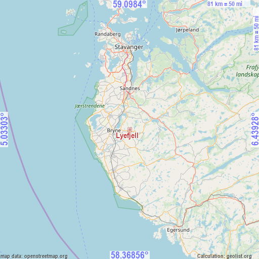
Lyefjell GPS coordinates[2]
58° 44' 7.404" North, 5° 44' 10.14" East
| Map corner | latitude | longitude |
|---|---|---|
| Upper-left | 59.0984°, | 5.03303° |
| Center: | 58.73539°, | 5.73615° |
| Lower-right: | 58.36856°, | 6.43928° |
| Map W x H: | 81.2×81.1 km | = 50.5×50.4mi |
| max Lat: | 71.04137° ⇑92.9% North |
| Lyefjell: | 58.73539° |
| min Lat: | ⇓7.1% South 58.0274° |
| min Long | Lyefjell | max Long |
| 4.71485° | 5.73615° | 31.11066° |
| W 13.3%⇐ | ⇒86.7% E |
Elevation
Elevation of Lyefjell is 118 m = 387 ft, and this is 13.8 m = 45 ft above average elevation for this country.
| Max E: |
897 m = 2943 ft | 31.2% |
| Lyefjell | 118 m 387 ft | |
| Avg. | 104.2 m = 342 ft | |
Min E: |
1 m = 3 ft | 68.8% |
See also: Norway elevation on elevation.city.
Geographical zone
Lyefjell is located in North temperate zone (between Tropic of Cancer and the Arctic Circle). Distance of this North polar circle is 870.4 km =540.8 mi to North.| Distance of | km | miles | from Lyefjell |
|---|---|---|---|
| North Pole | 3476.3 | 2160.1 | to North |
| Arctic Circle | 870.4 | 540.8 | to North |
| Tropic Cancer | 3924.8 | 2438.8 | to South |
| Equator | 6530.8 | 4058 | to South |


Nearby cities:
15 places around Lyefjell: (largest is in red/bold)
• Bryne
5.1 km =3.2 mi,  269°
269°
• Forsand
28.3 km =17.6 mi,  48°
48°
• Hellvik
29.8 km =18.5 mi,  163°
163°
• Hommersåk
22.2 km =13.8 mi,  17°
17°
• Kleppe
7.5 km =4.7 mi,  305°
305°
• Nærbø
9.6 km =6 mi,  216°
216°
• Oltedal
20.2 km =12.6 mi,  59°
59°
• Sandnes
13 km =8.1 mi,  359°
359°
• Sola
17.7 km =11 mi,  344°
344°
• Stavanger
26.1 km =16.2 mi, 359°
• Tananger
24.2 km =15 mi, 337°
• Varhaug
13.8 km =8.6 mi,  199°
199°
• Vigrestad
18.5 km =11.5 mi,  189°
189°
• Vikeså
23.2 km =14.4 mi,  117°
117°
• Ålgård
7.4 km =4.6 mi, 64°
Sources, notices
• [Note1] Compared only with cities in Norway existing in our database
• [Src1] Map data: © OpenStreetMap contributors (CC-BY-SA)
• [Src2] Other city data from geonames.org with taken over terms of usage.
• [Src3] Geographical zone / Annual Mean Temperature by Robert A. Rohde @ Wikipedia
