Straumen geodata
Straumen (Nordland) is a seat of a second-order administrative division; located in Norway in Europe/Oslo (GMT+2) time zone. With population of 827 people, there are 352 cities with bigger population in this country. Compared to other cities in Norway, 87.8% of cities are located further ↓South; 90.8% of cities are located further ←West and 54.9% of cities have lower elevation than Straumen. Note1


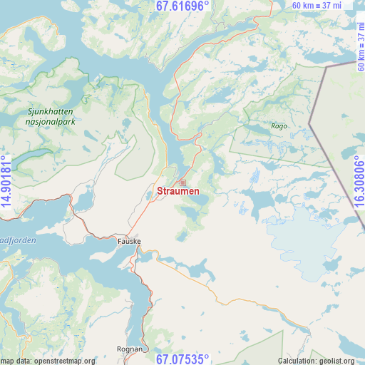
Straumen GPS coordinates[2]
67° 20' 51.684" North, 15° 36' 17.748" East
| Map corner | latitude | longitude |
|---|---|---|
| Upper-left | 67.61696°, | 14.90181° |
| Center: | 67.34769°, | 15.60493° |
| Lower-right: | 67.07535°, | 16.30806° |
| Map W x H: | 60.2×60.2 km | = 37.4×37.4mi |
| max Lat: | 71.04137° ⇑12.2% North |
| Straumen: | 67.34769° |
| min Lat: | ⇓87.8% South 58.0274° |
| min Long | Straumen | max Long |
| 4.71485° | 15.60493° | 31.11066° |
| W 90.8%⇐ | ⇒9.2% E |
Elevation
Elevation of Straumen is 60 m = 197 ft, and this is 44.2 m = 145 ft below average elevation for this country.
| Max E: |
897 m = 2943 ft | 45.1% |
| Avg. | 104.2 m = 342 ft | |
| Straumen | 60 m = 197 ft | |
Min E: |
1 m = 3 ft | 54.9% |
See also: Norway elevation on elevation.city.
Geographical zone
Straumen is located in North Frigid zone (between North Pole and Arctic Circle). Distance of this North polar circle is 87.2 km =54.2 mi to South.| Distance of | km | miles | from Straumen |
|---|---|---|---|
| North Pole | 2518.7 | 1565 | to North |
| Arctic Circle | 87.2 | 54.2 | to South |
| Tropic Cancer | 4882.4 | 3033.8 | to South |
| Equator | 7488.4 | 4653.1 | to South |


Nearby cities:
15 places around Straumen: (largest is in red/bold)
• Bodø
52 km =32.3 mi,  261°
261°
• Fauske
13.5 km =8.4 mi,  222°
222°
• Glomfjord
93 km =57.8 mi,  230°
230°
• Inndyr
76.5 km =47.5 mi,  242°
242°
• Kabelvåg
107.1 km =66.5 mi,  333°
333°
• Kjøpsvik
89.4 km =55.6 mi,  21°
21°
• Leinesfjorden
53.7 km =33.4 mi, 332°
• Løding
37.5 km =23.3 mi, 261°
• Løpsmarka
49.7 km =30.9 mi,  265°
265°
• Moldjord
58.5 km =36.4 mi, 229°
• Oppeid
82 km =51 mi,  0°
0°
• Rognan
29 km =18 mi,  198°
198°
• Stamsund
114.2 km =71 mi,  319°
319°
• Svolvær
107.8 km =67 mi,  336°
336°
• Ørnes
97.9 km =60.8 mi, 237°
Sources, notices
• [Note1] Compared only with cities in Norway existing in our database
• [Src1] Map data: © OpenStreetMap contributors (CC-BY-SA)
• [Src2] Other city data from geonames.org with taken over terms of usage.
• [Src3] Geographical zone / Annual Mean Temperature by Robert A. Rohde @ Wikipedia
