Madḩā’ al Jadīdah geodata
Madḩā’ al Jadīdah (Musandam) is a populated place; located in Oman in Asia/Muscat (GMT+4) time zone. With population of 2,260 people, there are 29 cities with bigger population in this country. Compared to other cities in Oman, 93.5% of cities are located further ↓South; 80.6% of cities are located further →East and 54.8% of cities have higher elevation than Madḩā’ al Jadīdah. Note1


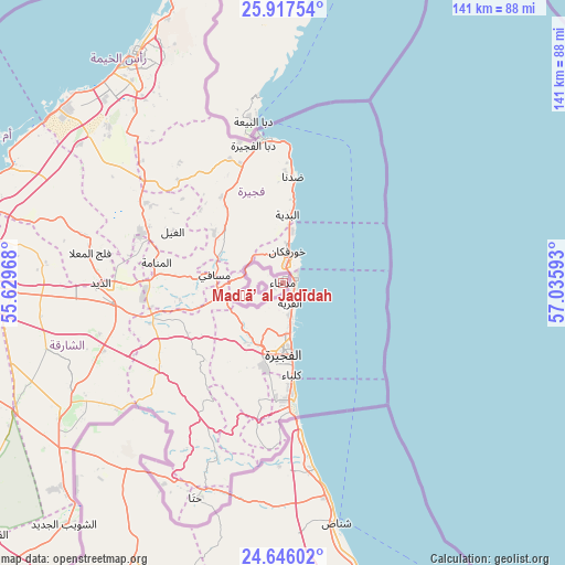
Madḩā’ al Jadīdah GPS coordinates[2]
25° 17' 0.42" North, 56° 19' 58.08" East
| Map corner | latitude | longitude |
|---|---|---|
| Upper-left | 25.91754°, | 55.62968° |
| Center: | 25.28345°, | 56.3328° |
| Lower-right: | 24.64602°, | 57.03593° |
| Map W x H: | 141.4×141.4 km | = 87.9×87.9mi |
| max Lat: | 26.19778° ⇑6.5% North |
| Madḩā’ al Jadīdah: | 25.28345° |
| min Lat: | ⇓93.5% South 17.01505° |
| min Long | Madḩā’ al | max Long |
| 52.66042° | 56.3328° | 59.52889° |
| W 19.4%⇐ | ⇒80.6% E |
Elevation
Elevation of Madḩā’ al Jadīdah is 58 m = 190 ft, and this is 148.7 m = 488 ft below average elevation for this country.
| Max E: |
684 m = 2244 ft | 54.8% |
| Avg. | 206.7 m = 678 ft | |
| Madḩā’ al Jadīdah | 58 m = 190 ft | |
Min E: |
1 m = 3 ft | 45.2% |
See also: Oman elevation on elevation.city.
Geographical zone
Madḩā’ al Jadīdah is located in North temperate zone (between Tropic of Cancer and the Arctic Circle). Distance of this Northern Tropic circle is 205.3 km =127.6 mi to South.| Distance of | km | miles | from Madḩā’ al Jadīdah |
|---|---|---|---|
| North Pole | 7195.8 | 4471.3 | to North |
| Arctic Circle | 4589.9 | 2852 | to North |
| Tropic Cancer | 205.3 | 127.6 | to South |
| Equator | 2811.3 | 1746.9 | to South |


Nearby cities:
15 places around Madḩā’ al Jadīdah: (largest is in red/bold)
• Al Buraymī
127.1 km =79 mi,  205°
205°
• Al Khābūrah
164.9 km =102.5 mi,  152°
152°
• As Suwayq
194.7 km =121 mi,  144°
144°
• Barkā’
237.8 km =147.8 mi, 138°
• Bayt al ‘Awābī
251.1 km =156 mi, 151°
• Dib Dibba
101.9 km =63.3 mi,  355°
355°
• Khasab
100 km =62.1 mi, 355°
• Liwá
86.9 km =54 mi,  164°
164°
• Oman Smart Future City
222 km =137.9 mi, 144°
• Rustaq
237.7 km =147.7 mi, 152°
• Shināş
61.6 km =38.3 mi,  167°
167°
• Sohar
110.8 km =68.8 mi, 159°
• Yanqul
189.8 km =117.9 mi, 173°
• Şaḩam
135.7 km =84.3 mi, 155°
• ‘Ibrī
229.5 km =142.6 mi,  175°
175°
Sources, notices
• [Note1] Compared only with cities in Oman existing in our database
• [Src1] Map data: © OpenStreetMap contributors (CC-BY-SA)
• [Src2] Other city data from geonames.org with taken over terms of usage.
• [Src3] Geographical zone / Annual Mean Temperature by Robert A. Rohde @ Wikipedia
