Khasab geodata
Khasab (Musandam) is a seat of a first-order administrative division; located in Oman in Asia/Muscat (GMT+4) time zone. With population of 17,904 people, there are 23 cities with bigger population in this country. Compared to other cities in Oman, 96.8% of cities are located further ↓South; 90.3% of cities are located further →East and 71% of cities have higher elevation than Khasab. Note1


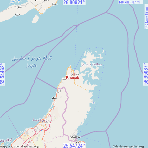
Khasab GPS coordinates[2]
26° 10' 47.748" North, 56° 14' 51.864" East
| Map corner | latitude | longitude |
|---|---|---|
| Upper-left | 26.80921°, | 55.54462° |
| Center: | 26.17993°, | 56.24774° |
| Lower-right: | 25.54724°, | 56.95087° |
| Map W x H: | 140.3×140.3 km | = 87.2×87.2mi |
| max Lat: | 26.19778° ⇑3.2% North |
| Khasab: | 26.17993° |
| min Lat: | ⇓96.8% South 17.01505° |
| min Long | Khasab | max Long |
| 52.66042° | 56.24774° | 59.52889° |
| W 9.7%⇐ | ⇒90.3% E |
Elevation
Elevation of Khasab is 13 m = 43 ft, and this is 193.7 m = 635 ft below average elevation for this country.
| Max E: |
684 m = 2244 ft | 71% |
| Avg. | 206.7 m = 678 ft | |
| Khasab | 13 m = 43 ft | |
Min E: |
1 m = 3 ft | 29% |
See also: Oman elevation on elevation.city.
Geographical zone
Khasab is located in North temperate zone (between Tropic of Cancer and the Arctic Circle). Distance of this Northern Tropic circle is 305 km =189.5 mi to South.| Distance of | km | miles | from Khasab |
|---|---|---|---|
| North Pole | 7096.1 | 4409.3 | to North |
| Arctic Circle | 4490.2 | 2790.1 | to North |
| Tropic Cancer | 305 | 189.5 | to South |
| Equator | 2910.9 | 1808.7 | to South |


Nearby cities:
15 places around Khasab: (largest is in red/bold)
• Al Buraymī
219.3 km =136.3 mi,  192°
192°
• Al Khābūrah
259.9 km =161.5 mi,  160°
160°
• As Suwayq
285.6 km =177.5 mi, 155°
• Barkā’
323.5 km =201 mi,  149°
149°
• Dib Dibba
2.2 km =1.4 mi,  26°
26°
• Liwá
186.1 km =115.6 mi,  170°
170°
• Madḩā’ al Jadīdah
100 km =62.1 mi,  175°
175°
• Oman Smart Future City
312.3 km =194.1 mi, 154°
• Rustaq
332.1 km =206.4 mi, 159°
• Seeb
340.8 km =211.8 mi,  144°
144°
• Shināş
161.3 km =100.2 mi, 172°
• Sohar
209 km =129.9 mi, 167°
• Yanqul
289.9 km =180.1 mi, 174°
• Şaḩam
232.4 km =144.4 mi, 163°
• ‘Ibrī
329.6 km =204.8 mi, 175°
Sources, notices
• [Note1] Compared only with cities in Oman existing in our database
• [Src1] Map data: © OpenStreetMap contributors (CC-BY-SA)
• [Src2] Other city data from geonames.org with taken over terms of usage.
• [Src3] Geographical zone / Annual Mean Temperature by Robert A. Rohde @ Wikipedia
