Peñas Chatas geodata
Peñas Chatas (Herrera) is a seat of a third-order administrative division; located in Panama in America/Panama (GMT-5) time zone. With population of 358 people, there are 537 cities with bigger population in this country. Compared to other cities in Panama, 80.9% of cities are located further ↑North; 56.8% of cities are located further →East and 55.2% of cities have lower elevation than Peñas Chatas. Note1


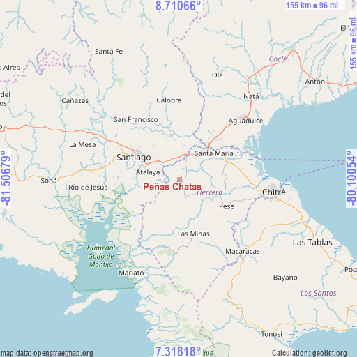
Peñas Chatas GPS coordinates[2]
8° 0' 54.072" North, 80° 48' 13.176" West
| Map corner | latitude | longitude |
|---|---|---|
| Upper-left | 8.71066°, | -81.50679° |
| Center: | 8.01502°, | -80.80366° |
| Lower-right: | 7.31818°, | -80.10054° |
| Map W x H: | 154.8×154.8 km | = 96.2×96.2mi |
| max Lat: | 9.60898° ⇑80.9% North |
| Peñas Chatas: | 8.01502° |
| min Lat: | ⇓19.1% South 7.26534° |
| min Long | Peñas Chatas | max Long |
| -82.91275° | -80.80366° | -77.38965° |
| W 43.2%⇐ | ⇒56.8% E |
Elevation
Elevation of Peñas Chatas is 88 m = 289 ft, and this is 84.1 m = 276 ft below average elevation for this country.
| Max E: |
2103 m = 6900 ft | 44.8% |
| Avg. | 172.1 m = 565 ft | |
| Peñas Chatas | 88 m = 289 ft | |
Min E: |
-1 m = -3 ft | 55.2% |
See also: Panama elevation on elevation.city.
Geographical zone
Peñas Chatas is located in North Torrid zone (between Equator and Tropic of Cancer). Distance of Equator is 891.2 km =553.8 mi to South.| Distance of | km | miles | from Peñas Chatas |
|---|---|---|---|
| North Pole | 9115.9 | 5664.4 | to North |
| Arctic Circle | 6510 | 4045.1 | to North |
| Tropic Cancer | 1714.7 | 1065.5 | to North |
| Equator | 891.2 | 553.8 | to South |


Nearby cities:
15 places around Peñas Chatas: (largest is in red/bold)
• Atalaya
13.7 km =8.5 mi,  282°
282°
• Cabuya
5.6 km =3.5 mi,  129°
129°
• Chupampa
7.4 km =4.6 mi,  23°
23°
• El Espino de Santa Rosa
8.9 km =5.5 mi,  345°
345°
• El Limón
5.9 km =3.7 mi,  35°
35°
• El Pedernal
14.3 km =8.9 mi,  9°
9°
• La Carrillo
10.2 km =6.3 mi,  240°
240°
• La Mata
11.8 km =7.3 mi,  314°
314°
• La Montañuela
6.7 km =4.2 mi, 279°
• Las Guabas
11.7 km =7.3 mi,  181°
181°
• Llano Grande
11.2 km =7 mi,  114°
114°
• Los Boquerones
9.1 km =5.7 mi,  321°
321°
• Los Canelos
15.5 km =9.6 mi, 42°
• Ocú
8.7 km =5.4 mi,  162°
162°
• San José
8.5 km =5.3 mi,  214°
214°
Sources, notices
• [Note1] Compared only with cities in Panama existing in our database
• [Src1] Map data: © OpenStreetMap contributors (CC-BY-SA)
• [Src2] Other city data from geonames.org with taken over terms of usage.
• [Src3] Geographical zone / Annual Mean Temperature by Robert A. Rohde @ Wikipedia
