Iparia geodata
Iparia (Ucayali) is a seat of a third-order administrative division; located in Peru in America/Lima (GMT-5) time zone. In our database, there are 305 cities with bigger population. Compared to other cities in Peru, 66.2% of cities are located further ↓South; 61.6% of cities are located further ←West and 82.6% of cities have higher elevation than Iparia. Note1


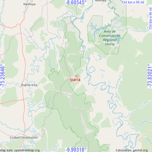
Iparia GPS coordinates[2]
9° 18' 0" South, 74° 31' 59.988" West
| Map corner | latitude | longitude |
|---|---|---|
| Upper-left | -8.60545°, | -75.23646° |
| Center: | -9.3°, | -74.53333° |
| Lower-right: | -9.99318°, | -73.83021° |
| Map W x H: | 154.3×154.3 km | = 95.9×95.9mi |
| max Lat: | -0.96667° ⇑33.8% North |
| Iparia: | -9.3° |
| min Lat: | ⇓66.2% South -18.01465° |
| min Long | Iparia | max Long |
| -81.30472° | -74.53333° | -69.04167° |
| W 61.6%⇐ | ⇒38.4% E |
Elevation
Elevation of Iparia is 239 m = 784 ft, and this is 2079.7 m = 6823 ft below average elevation for this country.
| Max E: |
5022 m = 16476 ft | 82.6% |
| Avg. | 2318.7 m = 7607 ft | |
| Iparia | 239 m = 784 ft | |
Min E: |
1 m = 3 ft | 17.4% |
See also: Peru elevation on elevation.city.
Geographical zone
Iparia is located in South Torrid zone (between Equator and Tropic of Capricorn). Distance of Equator is 1034.1 km =642.6 mi to North.| Distance of | km | miles | from Iparia |
|---|---|---|---|
| Equator | 1034.1 | 642.6 | to North |
| Tropic Capricorn | 1571.9 | 976.7 | to South |
| Antarctic Circle | 6367.1 | 3956.3 | to South |
| South Pole | 8973 | 5575.6 | to South |


Nearby cities:
15 places around Iparia: (largest is in red/bold)
• Bolognesi
102.8 km =63.9 mi,  145°
145°
• Campoverde
96.5 km =60 mi,  341°
341°
• Chaglla
161.9 km =100.6 mi,  248°
248°
• Honoria
62.1 km =38.6 mi, 341°
• Huancabamba
160.1 km =99.5 mi,  223°
223°
• Las Palmas
161.7 km =100.5 mi,  266°
266°
• Masisea
81.2 km =50.5 mi,  18°
18°
• Nueva Requena
115.7 km =71.9 mi, 341°
• Pozuzo
138.9 km =86.3 mi,  232°
232°
• Pucallpa
102.4 km =63.6 mi,  358°
358°
• Puerto Callao
104.8 km =65.1 mi, 357°
• Puerto Inca
48.2 km =30 mi,  259°
259°
• Tingo María
160.5 km =99.7 mi, 270°
• Tournavista
45.4 km =28.2 mi, 335°
• Yuyapichis
60.7 km =37.7 mi, 233°
Sources, notices
• [Note1] Compared only with cities in Peru existing in our database
• [Src1] Map data: © OpenStreetMap contributors (CC-BY-SA)
• [Src2] Other city data from geonames.org with taken over terms of usage.
• [Src3] Geographical zone / Annual Mean Temperature by Robert A. Rohde @ Wikipedia
