Puerto Callao geodata
Puerto Callao (Ucayali) is a seat of a third-order administrative division; located in Peru in America/Lima (GMT-5) time zone. In our database, there are 305 cities with bigger population. Compared to other cities in Peru, 71.7% of cities are located further ↓South; 61.3% of cities are located further ←West and 86.5% of cities have higher elevation than Puerto Callao. Note1
Administrative division(s):
- Level 1: Ucayali
- Level 2: Provincia de Coronel Portillo
- Level 3: Yarinacocha


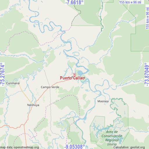
Puerto Callao GPS coordinates[2]
8° 21' 29.016" South, 74° 34' 24.996" West
| Map corner | latitude | longitude |
|---|---|---|
| Upper-left | -7.6618°, | -75.27674° |
| Center: | -8.35806°, | -74.57361° |
| Lower-right: | -9.05308°, | -73.87049° |
| Map W x H: | 154.7×154.7 km | = 96.1×96.1mi |
| max Lat: | -0.96667° ⇑28.3% North |
| Puerto Callao: | -8.35806° |
| min Lat: | ⇓71.7% South -18.01465° |
| min Long | Puerto Callao | max Long |
| -81.30472° | -74.57361° | -69.04167° |
| W 61.3%⇐ | ⇒38.7% E |
Elevation
Elevation of Puerto Callao is 153 m = 502 ft, and this is 2165.7 m = 7105 ft below average elevation for this country.
| Max E: |
5022 m = 16476 ft | 86.5% |
| Avg. | 2318.7 m = 7607 ft | |
| Puerto Callao | 153 m = 502 ft | |
Min E: |
1 m = 3 ft | 13.5% |
See also: Peru elevation on elevation.city.
Geographical zone
Puerto Callao is located in South Torrid zone (between Equator and Tropic of Capricorn). Distance of Equator is 929.3 km =577.4 mi to North.| Distance of | km | miles | from Puerto Callao |
|---|---|---|---|
| Equator | 929.3 | 577.4 | to North |
| Tropic Capricorn | 1676.6 | 1041.8 | to South |
| Antarctic Circle | 6471.8 | 4021.4 | to South |
| South Pole | 9077.7 | 5640.6 | to South |


Nearby cities:
15 places around Puerto Callao: (largest is in red/bold)
• Aucayacu
180.8 km =112.3 mi,  249°
249°
• Campoverde
28.8 km =17.9 mi,  243°
243°
• Contamana
124 km =77.1 mi,  336°
336°
• Honoria
48.1 km =29.9 mi,  198°
198°
• Inahuaya
155.4 km =96.6 mi,  329°
329°
• Iparia
104.8 km =65.1 mi,  177°
177°
• Masisea
40.4 km =25.1 mi,  132°
132°
• Nueva Requena
32.2 km =20 mi,  279°
279°
• Orellana
174.8 km =108.6 mi, 338°
• Pampa Hermosa
151.6 km =94.2 mi, 328°
• Pucallpa
3.2 km =2 mi,  137°
137°
• Puerto Inca
121.2 km =75.3 mi, 200°
• Tingo María
187.8 km =116.7 mi, 236°
• Tournavista
65.2 km =40.5 mi,  193°
193°
• Yuyapichis
147.9 km =91.9 mi, 197°
Sources, notices
• [Note1] Compared only with cities in Peru existing in our database
• [Src1] Map data: © OpenStreetMap contributors (CC-BY-SA)
• [Src2] Other city data from geonames.org with taken over terms of usage.
• [Src3] Geographical zone / Annual Mean Temperature by Robert A. Rohde @ Wikipedia
