Nueva Requena geodata
Nueva Requena (Ucayali) is a seat of a third-order administrative division; located in Peru in America/Lima (GMT-5) time zone. In our database, there are 305 cities with bigger population. Compared to other cities in Peru, 72% of cities are located further ↓South; 59.8% of cities are located further ←West and 86.7% of cities have higher elevation than Nueva Requena. Note1
Administrative division(s):
- Level 1: Ucayali
- Level 2: Provincia de Coronel Portillo
- Level 3: Nueva Requena


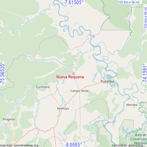
Nueva Requena GPS coordinates[2]
8° 18' 41.004" South, 74° 51' 43.992" West
| Map corner | latitude | longitude |
|---|---|---|
| Upper-left | -7.61505°, | -75.56535° |
| Center: | -8.31139°, | -74.86222° |
| Lower-right: | -9.0065°, | -74.1591° |
| Map W x H: | 154.7×154.7 km | = 96.1×96.1mi |
| max Lat: | -0.96667° ⇑28% North |
| Nueva Requena: | -8.31139° |
| min Lat: | ⇓72% South -18.01465° |
| min Long | Nueva Requena | max Long |
| -81.30472° | -74.86222° | -69.04167° |
| W 59.8%⇐ | ⇒40.2% E |
Elevation
Elevation of Nueva Requena is 151 m = 495 ft, and this is 2167.7 m = 7112 ft below average elevation for this country.
| Max E: |
5022 m = 16476 ft | 86.7% |
| Avg. | 2318.7 m = 7607 ft | |
| Nueva Requena | 151 m = 495 ft | |
Min E: |
1 m = 3 ft | 13.3% |
See also: Peru elevation on elevation.city.
Geographical zone
Nueva Requena is located in South Torrid zone (between Equator and Tropic of Capricorn). Distance of Equator is 924.1 km =574.2 mi to North.| Distance of | km | miles | from Nueva Requena |
|---|---|---|---|
| Equator | 924.1 | 574.2 | to North |
| Tropic Capricorn | 1681.8 | 1045 | to South |
| Antarctic Circle | 6477 | 4024.6 | to South |
| South Pole | 9082.9 | 5643.9 | to South |


Nearby cities:
15 places around Nueva Requena: (largest is in red/bold)
• Aucayacu
153.8 km =95.6 mi,  243°
243°
• Campoverde
19.2 km =11.9 mi,  161°
161°
• Contamana
110.1 km =68.4 mi,  351°
351°
• Honoria
53.6 km =33.3 mi, 161°
• Inahuaya
137.2 km =85.3 mi,  340°
340°
• Iparia
115.7 km =71.9 mi, 161°
• Masisea
69.5 km =43.2 mi,  118°
118°
• Nuevo Progreso
161.6 km =100.4 mi,  264°
264°
• Orellana
160.5 km =99.7 mi, 347°
• Pampa Hermosa
132.7 km =82.5 mi, 338°
• Pucallpa
34.7 km =21.6 mi,  102°
102°
• Puerto Callao
32.2 km =20 mi, 99°
• Puerto Inca
119 km =73.9 mi,  185°
185°
• Tournavista
70.8 km =44 mi,  166°
166°
• Yuyapichis
146.9 km =91.3 mi,  184°
184°
Sources, notices
• [Note1] Compared only with cities in Peru existing in our database
• [Src1] Map data: © OpenStreetMap contributors (CC-BY-SA)
• [Src2] Other city data from geonames.org with taken over terms of usage.
• [Src3] Geographical zone / Annual Mean Temperature by Robert A. Rohde @ Wikipedia
