Yuyapichis geodata
Yuyapichis (Huanuco) is a seat of a third-order administrative division; located in Peru in America/Lima (GMT-5) time zone. In our database, there are 305 cities with bigger population. Compared to other cities in Peru, 63.9% of cities are located further ↓South; 58.9% of cities are located further ←West and 83.5% of cities have higher elevation than Yuyapichis. Note1


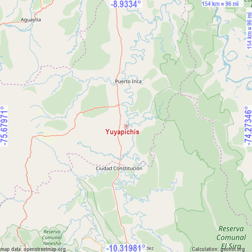
Yuyapichis GPS coordinates[2]
9° 37' 38.352" South, 74° 58' 35.688" West
| Map corner | latitude | longitude |
|---|---|---|
| Upper-left | -8.9334°, | -75.67971° |
| Center: | -9.62732°, | -74.97658° |
| Lower-right: | -10.31981°, | -74.27346° |
| Map W x H: | 154.2×154.2 km | = 95.8×95.8mi |
| max Lat: | -0.96667° ⇑36.1% North |
| Yuyapichis: | -9.62732° |
| min Lat: | ⇓63.9% South -18.01465° |
| min Long | Yuyapichis | max Long |
| -81.30472° | -74.97658° | -69.04167° |
| W 58.9%⇐ | ⇒41.1% E |
Elevation
Elevation of Yuyapichis is 216 m = 709 ft, and this is 2102.7 m = 6899 ft below average elevation for this country.
| Max E: |
5022 m = 16476 ft | 83.5% |
| Avg. | 2318.7 m = 7607 ft | |
| Yuyapichis | 216 m = 709 ft | |
Min E: |
1 m = 3 ft | 16.5% |
See also: Peru elevation on elevation.city.
Geographical zone
Yuyapichis is located in South Torrid zone (between Equator and Tropic of Capricorn). Distance of Equator is 1070.5 km =665.2 mi to North.| Distance of | km | miles | from Yuyapichis |
|---|---|---|---|
| Equator | 1070.5 | 665.2 | to North |
| Tropic Capricorn | 1535.5 | 954.1 | to South |
| Antarctic Circle | 6330.7 | 3933.7 | to South |
| South Pole | 8936.6 | 5552.9 | to South |


Nearby cities:
15 places around Yuyapichis: (largest is in red/bold)
• Acomayo
121.6 km =75.6 mi,  260°
260°
• Bolognesi
117 km =72.7 mi,  114°
114°
• Chaglla
104.3 km =64.8 mi, 256°
• Chontabamba
119.9 km =74.5 mi,  207°
207°
• Honoria
99.8 km =62 mi,  17°
17°
• Huancabamba
100.9 km =62.7 mi,  217°
217°
• Iparia
60.7 km =37.7 mi,  53°
53°
• Las Palmas
116 km =72.1 mi,  283°
283°
• Oxapampa
115.4 km =71.7 mi,  203°
203°
• Panao
115.4 km =71.7 mi,  254°
254°
• Pozuzo
78.1 km =48.5 mi,  231°
231°
• Puerto Inca
27.9 km =17.3 mi,  2°
2°
• Tingo María
117.7 km =73.1 mi,  288°
288°
• Tournavista
83 km =51.6 mi, 20°
• Villa Rica
127.7 km =79.3 mi,  194°
194°
Sources, notices
• [Note1] Compared only with cities in Peru existing in our database
• [Src1] Map data: © OpenStreetMap contributors (CC-BY-SA)
• [Src2] Other city data from geonames.org with taken over terms of usage.
• [Src3] Geographical zone / Annual Mean Temperature by Robert A. Rohde @ Wikipedia
