Campoverde geodata
Campoverde (Ucayali) is a populated place; located in Peru in America/Lima (GMT-5) time zone. With population of 8,945 people, there are 158 cities with bigger population in this country. Compared to other cities in Peru, 70.9% of cities are located further ↓South; 59.9% of cities are located further ←West and 84.4% of cities have higher elevation than Campoverde. Note1
Administrative division(s):
- Level 1: Ucayali
- Level 2: Provincia de Coronel Portillo
- Level 3: Campoverde


Campoverde GPS coordinates[2]
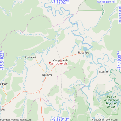
8° 28' 31.188" South, 74° 48' 25.524" West
| Map corner | latitude | longitude |
|---|---|---|
| Upper-left | -7.77927°, | -75.51022° |
| Center: | -8.47533°, | -74.80709° |
| Lower-right: | -9.17013°, | -74.10397° |
| Map W x H: | 154.6×154.7 km | = 96.1×96.1mi |
| max Lat: | -0.96667° ⇑29.1% North |
| Campoverde: | -8.47533° |
| min Lat: | ⇓70.9% South -18.01465° |
| min Long | Campoverde | max Long |
| -81.30472° | -74.80709° | -69.04167° |
| W 59.9%⇐ | ⇒40.1% E |
Elevation
Elevation of Campoverde is 198 m = 650 ft, and this is 2120.7 m = 6958 ft below average elevation for this country.
| Max E: |
5022 m = 16476 ft | 84.4% |
| Avg. | 2318.7 m = 7607 ft | |
| Campoverde | 198 m = 650 ft | |
Min E: |
1 m = 3 ft | 15.6% |
See also: Peru elevation on elevation.city.
Geographical zone
Campoverde is located in South Torrid zone (between Equator and Tropic of Capricorn). Distance of Equator is 942.4 km =585.6 mi to North.| Distance of | km | miles | from Campoverde |
|---|---|---|---|
| Equator | 942.4 | 585.6 | to North |
| Tropic Capricorn | 1663.6 | 1033.7 | to South |
| Antarctic Circle | 6458.8 | 4013.3 | to South |
| South Pole | 9064.7 | 5632.5 | to South |


Nearby cities:
15 places around Campoverde: (largest is in red/bold)
• Aucayacu
152.2 km =94.6 mi,  250°
250°
• Contamana
129.1 km =80.2 mi,  349°
349°
• Honoria
34.4 km =21.4 mi,  161°
161°
• Inahuaya
156.4 km =97.2 mi,  340°
340°
• Iparia
96.5 km =60 mi, 161°
• Las Palmas
165.9 km =103.1 mi,  232°
232°
• Masisea
57.1 km =35.5 mi,  104°
104°
• Nueva Requena
19.2 km =11.9 mi, 341°
• Pampa Hermosa
151.8 km =94.3 mi, 339°
• Pucallpa
29.8 km =18.5 mi,  68°
68°
• Puerto Callao
28.8 km =17.9 mi,  63°
63°
• Puerto Inca
101.8 km =63.3 mi,  189°
189°
• Tingo María
159.3 km =99 mi,  235°
235°
• Tournavista
51.7 km =32.1 mi,  167°
167°
• Yuyapichis
129.4 km =80.4 mi, 188°
Sources, notices
• [Note1] Compared only with cities in Peru existing in our database
• [Src1] Map data: © OpenStreetMap contributors (CC-BY-SA)
• [Src2] Other city data from geonames.org with taken over terms of usage.
• [Src3] Geographical zone / Annual Mean Temperature by Robert A. Rohde @ Wikipedia
