Pucallpa geodata
Pucallpa (Ucayali) is a seat of a first-order administrative division; located in Peru in America/Lima (GMT-5) time zone. With population of 310,750 people, there are 10 cities with bigger population in this country. Compared to other cities in Peru, 71.6% of cities are located further ↓South; 61.5% of cities are located further ←West and 86.2% of cities have higher elevation than Pucallpa. Note1
Administrative division(s):
- Level 1: Ucayali
- Level 2: Provincia de Coronel Portillo
- Level 3: Calleria


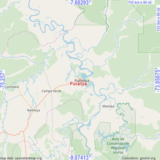
Pucallpa GPS coordinates[2]
8° 22' 44.94" South, 74° 33' 13.932" West
| Map corner | latitude | longitude |
|---|---|---|
| Upper-left | -7.68293°, | -75.257° |
| Center: | -8.37915°, | -74.55387° |
| Lower-right: | -9.07413°, | -73.85075° |
| Map W x H: | 154.7×154.7 km | = 96.1×96.1mi |
| max Lat: | -0.96667° ⇑28.4% North |
| Pucallpa: | -8.37915° |
| min Lat: | ⇓71.6% South -18.01465° |
| min Long | Pucallpa | max Long |
| -81.30472° | -74.55387° | -69.04167° |
| W 61.5%⇐ | ⇒38.5% E |
Elevation
Elevation of Pucallpa is 155 m = 509 ft, and this is 2163.7 m = 7099 ft below average elevation for this country.
| Max E: |
5022 m = 16476 ft | 86.2% |
| Avg. | 2318.7 m = 7607 ft | |
| Pucallpa | 155 m = 509 ft | |
Min E: |
1 m = 3 ft | 13.8% |
See also: Pucallpa elevation on elevation.city.
Geographical zone
Pucallpa is located in South Torrid zone (between Equator and Tropic of Capricorn). Distance of Equator is 931.7 km =578.9 mi to North.| Distance of | km | miles | from Pucallpa |
|---|---|---|---|
| Equator | 931.7 | 578.9 | to North |
| Tropic Capricorn | 1674.2 | 1040.3 | to South |
| Antarctic Circle | 6469.5 | 4020 | to South |
| South Pole | 9075.4 | 5639.2 | to South |


Nearby cities:
15 places around Pucallpa: (largest is in red/bold)
• Aucayacu
182.1 km =113.2 mi,  250°
250°
• Campoverde
29.8 km =18.5 mi, 248°
• Contamana
127 km =78.9 mi,  336°
336°
• Honoria
46.6 km =29 mi,  201°
201°
• Inahuaya
158.5 km =98.5 mi,  329°
329°
• Iparia
102.4 km =63.6 mi,  178°
178°
• Masisea
37.2 km =23.1 mi,  132°
132°
• Nueva Requena
34.7 km =21.6 mi,  282°
282°
• Orellana
177.8 km =110.5 mi, 337°
• Pampa Hermosa
154.7 km =96.1 mi, 327°
• Puerto Callao
3.2 km =2 mi,  317°
317°
• Puerto Inca
119.8 km =74.4 mi, 202°
• Tingo María
188.3 km =117 mi,  237°
237°
• Tournavista
63.5 km =39.5 mi, 195°
• Yuyapichis
146.3 km =90.9 mi, 198°
Sources, notices
• [Note1] Compared only with cities in Peru existing in our database
• [Src1] Map data: © OpenStreetMap contributors (CC-BY-SA)
• [Src2] Other city data from geonames.org with taken over terms of usage.
• [Src3] Geographical zone / Annual Mean Temperature by Robert A. Rohde @ Wikipedia
