Warah geodata
Warah (Sindh) is a populated place; located in Pakistan in Asia/Karachi (GMT+5) time zone. With population of 18,724 people, there are 279 cities with bigger population in this country. Compared to other cities in Pakistan, 77.9% of cities are located further ↑North; 91.4% of cities are located further →East and 81.9% of cities have higher elevation than Warah. Note1


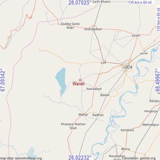
Warah GPS coordinates[2]
27° 26' 52.98" North, 67° 47' 47.544" East
| Map corner | latitude | longitude |
|---|---|---|
| Upper-left | 28.07025°, | 67.09342° |
| Center: | 27.44805°, | 67.79654° |
| Lower-right: | 26.82232°, | 68.49967° |
| Map W x H: | 138.8×138.8 km | = 86.2×86.2mi |
| max Lat: | 36.32162° ⇑77.9% North |
| Warah: | 27.44805° |
| min Lat: | ⇓22.1% South 24.14422° |
| min Long | Warah | max Long |
| 61.74573° | 67.79654° | 75.63372° |
| W 8.6%⇐ | ⇒91.4% E |
Elevation
Elevation of Warah is 51 m = 167 ft, and this is 294 m = 965 ft below average elevation for this country.
| Max E: |
2732 m = 8963 ft | 81.9% |
| Avg. | 345 m = 1132 ft | |
| Warah | 51 m = 167 ft | |
Min E: |
3 m = 10 ft | 18.1% |
See also: Pakistan elevation on elevation.city.
Geographical zone
Warah is located in North temperate zone (between Tropic of Cancer and the Arctic Circle). Distance of this Northern Tropic circle is 446 km =277.1 mi to South.| Distance of | km | miles | from Warah |
|---|---|---|---|
| North Pole | 6955.1 | 4321.7 | to North |
| Arctic Circle | 4349.2 | 2702.5 | to North |
| Tropic Cancer | 446 | 277.1 | to South |
| Equator | 3051.9 | 1896.4 | to South |


Nearby cities:
15 places around Warah: (largest is in red/bold)
• Dokri
30.8 km =19.1 mi,  105°
105°
• Goth Garelo
27.6 km =17.1 mi,  92°
92°
• Goth Radhan
31.8 km =19.8 mi,  150°
150°
• Kambar
25.4 km =15.8 mi,  52°
52°
• Kandiaro
59.5 km =37 mi,  136°
136°
• Khairpur Nathan Shah
40.2 km =25 mi,  188°
188°
• Larkana
42.8 km =26.6 mi,  73°
73°
• Mehar
29.9 km =18.6 mi,  175°
175°
• Miro Khan
45.3 km =28.1 mi,  40°
40°
• Nasirabad
14 km =8.7 mi,  122°
122°
• Naudero
60.7 km =37.7 mi, 66°
• New Bādāh
26.1 km =16.2 mi, 116°
• Shahdad Kot
45.7 km =28.4 mi,  13°
13°
• Sobhodero
61.4 km =38.2 mi, 105°
• Sīta Road
46.4 km =28.8 mi,  173°
173°
Sources, notices
• [Note1] Compared only with cities in Pakistan existing in our database
• [Src1] Map data: © OpenStreetMap contributors (CC-BY-SA)
• [Src2] Other city data from geonames.org with taken over terms of usage.
• [Src3] Geographical zone / Annual Mean Temperature by Robert A. Rohde @ Wikipedia
