Narang Mandi geodata
Narang Mandi (Punjab) is a populated place; located in Pakistan in Asia/Karachi (GMT+5) time zone. With population of 34,778 people, there are 181 cities with bigger population in this country. Compared to other cities in Pakistan, 64.8% of cities are located further ↓South; 96.4% of cities are located further ←West and 65.5% of cities have lower elevation than Narang Mandi. Note1


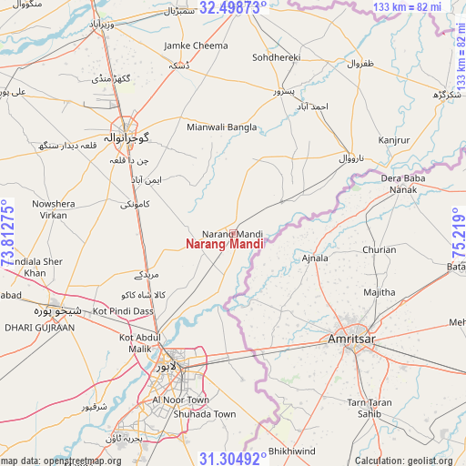
Narang Mandi GPS coordinates[2]
31° 54' 13.536" North, 74° 30' 57.132" East
| Map corner | latitude | longitude |
|---|---|---|
| Upper-left | 32.49873°, | 73.81275° |
| Center: | 31.90376°, | 74.51587° |
| Lower-right: | 31.30492°, | 75.219° |
| Map W x H: | 132.7×132.7 km | = 82.5×82.5mi |
| max Lat: | 36.32162° ⇑35.2% North |
| Narang Mandi: | 31.90376° |
| min Lat: | ⇓64.8% South 24.14422° |
| min Long | Narang Mandi | max Long |
| 61.74573° | 74.51587° | 75.63372° |
| W 96.4%⇐ | ⇒3.6% E |
Elevation
Elevation of Narang Mandi is 221 m = 725 ft, and this is 124 m = 407 ft below average elevation for this country.
| Max E: |
2732 m = 8963 ft | 34.5% |
| Avg. | 345 m = 1132 ft | |
| Narang Mandi | 221 m = 725 ft | |
Min E: |
3 m = 10 ft | 65.5% |
See also: Pakistan elevation on elevation.city.
Geographical zone
Narang Mandi is located in North temperate zone (between Tropic of Cancer and the Arctic Circle). Distance of this Northern Tropic circle is 941.4 km =585 mi to South.| Distance of | km | miles | from Narang Mandi |
|---|---|---|---|
| North Pole | 6459.7 | 4013.9 | to North |
| Arctic Circle | 3853.8 | 2394.6 | to North |
| Tropic Cancer | 941.4 | 585 | to South |
| Equator | 3547.4 | 2204.3 | to South |


Nearby cities:
15 places around Narang Mandi: (largest is in red/bold)
• Baddomalhi
17 km =10.6 mi,  55°
55°
• Chawinda
52.1 km =32.4 mi,  19°
19°
• Daska Kalan
49.3 km =30.6 mi,  341°
341°
• Eminabad
28.6 km =17.8 mi,  302°
302°
• Gujranwala
41.8 km =26 mi,  312°
312°
• Kalaswala
35.3 km =21.9 mi, 20°
• Kamoke
28.8 km =17.9 mi,  286°
286°
• Kot Ghulam Muhammad
47.8 km =29.7 mi,  3°
3°
• Ladhewala Waraich
47.1 km =29.3 mi, 306°
• Lahore
41.5 km =25.8 mi,  202°
202°
• Muridke
26.9 km =16.7 mi,  245°
245°
• Narowal
40.2 km =25 mi, 56°
• Naushahra Virkan
51.8 km =32.2 mi,  277°
277°
• Pasrur
42.3 km =26.3 mi, 19°
• Shekhupura
54.4 km =33.8 mi, 247°
Sources, notices
• [Note1] Compared only with cities in Pakistan existing in our database
• [Src1] Map data: © OpenStreetMap contributors (CC-BY-SA)
• [Src2] Other city data from geonames.org with taken over terms of usage.
• [Src3] Geographical zone / Annual Mean Temperature by Robert A. Rohde @ Wikipedia
