Sahiwal geodata
Sahiwal (Punjab) is a seat of a second-order administrative division; located in Pakistan in Asia/Karachi (GMT+5) time zone. With population of 235,695 people, there are 28 cities with bigger population in this country. Compared to other cities in Pakistan, 51.9% of cities are located further ↑North; 75.2% of cities are located further ←West and 51.9% of cities have higher elevation than Sahiwal. Note1


Sahiwal GPS coordinates[2]
30° 39' 57.42" North, 73° 6' 6.696" East
| Map corner | latitude | longitude |
|---|---|---|
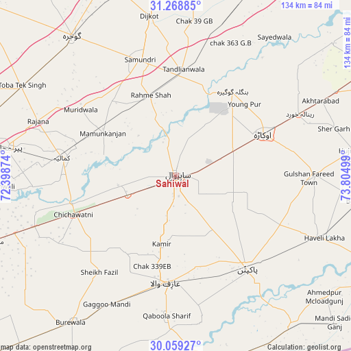
| Upper-left | 31.26885°, | 72.39874° |
| Center: | 30.66595°, | 73.10186° |
| Lower-right: | 30.05927°, | 73.80499° |
| Map W x H: | 134.5×134.5 km | = 83.6×83.6mi |
| max Lat: | 36.32162° ⇑51.9% North |
| Sahiwal: | 30.66595° |
| min Lat: | ⇓48.1% South 24.14422° |
| min Long | Sahiwal | max Long |
| 61.74573° | 73.10186° | 75.63372° |
| W 75.2%⇐ | ⇒24.8% E |
Elevation
Elevation of Sahiwal is 173 m = 568 ft, and this is 172 m = 564 ft below average elevation for this country.
| Max E: |
2732 m = 8963 ft | 51.9% |
| Avg. | 345 m = 1132 ft | |
| Sahiwal | 173 m = 568 ft | |
Min E: |
3 m = 10 ft | 48.1% |
See also: Sahiwal elevation on elevation.city.
Geographical zone
Sahiwal is located in North temperate zone (between Tropic of Cancer and the Arctic Circle). Distance of this Northern Tropic circle is 803.8 km =499.5 mi to South.| Distance of | km | miles | from Sahiwal |
|---|---|---|---|
| North Pole | 6597.3 | 4099.4 | to North |
| Arctic Circle | 3991.4 | 2480.1 | to North |
| Tropic Cancer | 803.8 | 499.5 | to South |
| Equator | 3409.7 | 2118.7 | to South |


Nearby cities:
15 places around Sahiwal: (largest is in red/bold)
• Arifwala
41.9 km =26 mi,  184°
184°
• Bahawalnagar
30.5 km =19 mi,  114°
114°
• Chak Azam Sahu
11.9 km =7.4 mi,  323°
323°
• Chak One Hundred Twenty Nine Left
26.9 km =16.7 mi,  191°
191°
• Chak Thirty-one -Eleven Left
47.2 km =29.3 mi,  235°
235°
• Chichawatni
42.1 km =26.2 mi,  248°
248°
• Dipalpur
52.7 km =32.7 mi,  89°
89°
• Haveli Lakha
61.5 km =38.2 mi, 112°
• Kamalia
44.1 km =27.4 mi,  278°
278°
• Mamu Kanjan
34.2 km =21.3 mi,  302°
302°
• Mustafābād
45.5 km =28.3 mi,  56°
56°
• Okara
37.1 km =23.1 mi, 64°
• Pakpattan
45.2 km =28.1 mi,  142°
142°
• Renala Khurd
53 km =32.9 mi, 63°
• Tandlianwala
41 km =25.5 mi,  4°
4°
Sources, notices
• [Note1] Compared only with cities in Pakistan existing in our database
• [Src1] Map data: © OpenStreetMap contributors (CC-BY-SA)
• [Src2] Other city data from geonames.org with taken over terms of usage.
• [Src3] Geographical zone / Annual Mean Temperature by Robert A. Rohde @ Wikipedia
