Garh Maharaja geodata
Garh Maharaja (Punjab) is a populated place; located in Pakistan in Asia/Karachi (GMT+5) time zone. With population of 29,153 people, there are 214 cities with bigger population in this country. Compared to other cities in Pakistan, 52.6% of cities are located further ↓South; 55.3% of cities are located further ←West and 60.9% of cities have higher elevation than Garh Maharaja. Note1


Garh Maharaja GPS coordinates[2]
30° 50' 1.788" North, 71° 54' 17.676" East
| Map corner | latitude | longitude |
|---|---|---|
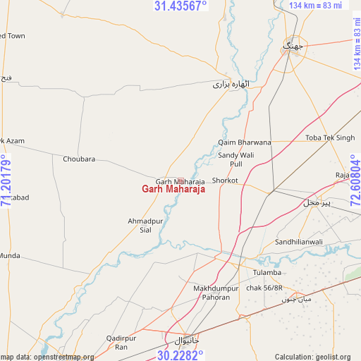
| Upper-left | 31.43567°, | 71.20179° |
| Center: | 30.83383°, | 71.90491° |
| Lower-right: | 30.2282°, | 72.60804° |
| Map W x H: | 134.3×134.3 km | = 83.5×83.5mi |
| max Lat: | 36.32162° ⇑47.4% North |
| Garh Maharaja: | 30.83383° |
| min Lat: | ⇓52.6% South 24.14422° |
| min Long | Garh Maharaja | max Long |
| 61.74573° | 71.90491° | 75.63372° |
| W 55.3%⇐ | ⇒44.7% E |
Elevation
Elevation of Garh Maharaja is 143 m = 469 ft, and this is 202 m = 663 ft below average elevation for this country.
| Max E: |
2732 m = 8963 ft | 60.9% |
| Avg. | 345 m = 1132 ft | |
| Garh Maharaja | 143 m = 469 ft | |
Min E: |
3 m = 10 ft | 39.1% |
See also: Pakistan elevation on elevation.city.
Geographical zone
Garh Maharaja is located in North temperate zone (between Tropic of Cancer and the Arctic Circle). Distance of this Northern Tropic circle is 822.5 km =511.1 mi to South.| Distance of | km | miles | from Garh Maharaja |
|---|---|---|---|
| North Pole | 6578.7 | 4087.8 | to North |
| Arctic Circle | 3972.8 | 2468.6 | to North |
| Tropic Cancer | 822.5 | 511.1 | to South |
| Equator | 3428.4 | 2130.3 | to South |


Nearby cities:
15 places around Garh Maharaja: (largest is in red/bold)
• Ahmadpur Sial
23.2 km =14.4 mi,  221°
221°
• Chak Two Hundred Forty-nine Thal Development Authority
76.9 km =47.8 mi,  299°
299°
• Jhang City
66 km =41 mi,  37°
37°
• Jhang Sadr
62.4 km =38.8 mi, 38°
• Kabirwala
47.9 km =29.8 mi,  184°
184°
• Kamalia
71.8 km =44.6 mi,  99°
99°
• Khanewal
59.2 km =36.8 mi, 177°
• Mankera
75.8 km =47.1 mi,  324°
324°
• Mian Channun
61.5 km =38.2 mi,  135°
135°
• Multan
81.8 km =50.8 mi,  209°
209°
• Pir Mahal
51.1 km =31.8 mi, 98°
• Qadirpur Ran
64.3 km =40 mi,  200°
200°
• Sarai Sidhu
27.3 km =17 mi,  166°
166°
• Talamba
46.9 km =29.1 mi, 136°
• Toba Tek Singh
57.2 km =35.5 mi,  74°
74°
Sources, notices
• [Note1] Compared only with cities in Pakistan existing in our database
• [Src1] Map data: © OpenStreetMap contributors (CC-BY-SA)
• [Src2] Other city data from geonames.org with taken over terms of usage.
• [Src3] Geographical zone / Annual Mean Temperature by Robert A. Rohde @ Wikipedia
