Dera Ghazi Khan geodata
Dera Ghazi Khan (Punjab) is a seat of a second-order administrative division; located in Pakistan in Asia/Karachi (GMT+5) time zone. With population of 236,093 people, there are 27 cities with bigger population in this country. Compared to other cities in Pakistan, 58.5% of cities are located further ↑North; 59.1% of cities are located further →East and 65.5% of cities have higher elevation than Dera Ghazi Khan. Note1


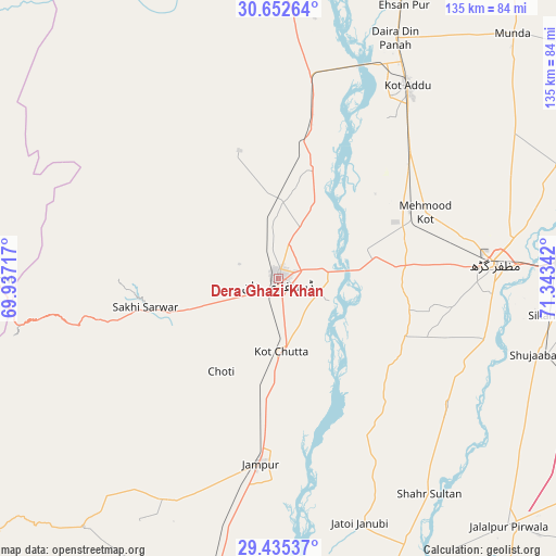
Dera Ghazi Khan GPS coordinates[2]
30° 2' 45.132" North, 70° 38' 25.044" East
| Map corner | latitude | longitude |
|---|---|---|
| Upper-left | 30.65264°, | 69.93717° |
| Center: | 30.04587°, | 70.64029° |
| Lower-right: | 29.43537°, | 71.34342° |
| Map W x H: | 135.3×135.3 km | = 84.1×84.1mi |
| max Lat: | 36.32162° ⇑58.5% North |
| Dera Ghazi Khan: | 30.04587° |
| min Lat: | ⇓41.5% South 24.14422° |
| min Long | Dera Ghazi Khan | max Long |
| 61.74573° | 70.64029° | 75.63372° |
| W 40.9%⇐ | ⇒59.1% E |
Elevation
Elevation of Dera Ghazi Khan is 122 m = 400 ft, and this is 223 m = 732 ft below average elevation for this country.
| Max E: |
2732 m = 8963 ft | 65.5% |
| Avg. | 345 m = 1132 ft | |
| Dera Ghazi Khan | 122 m = 400 ft | |
Min E: |
3 m = 10 ft | 34.5% |
See also: Dera Ghazi Khan elevation on elevation.city.
Geographical zone
Dera Ghazi Khan is located in North temperate zone (between Tropic of Cancer and the Arctic Circle). Distance of this Northern Tropic circle is 734.9 km =456.6 mi to South.| Distance of | km | miles | from Dera Ghazi Khan |
|---|---|---|---|
| North Pole | 6666.3 | 4142.2 | to North |
| Arctic Circle | 4060.4 | 2523 | to North |
| Tropic Cancer | 734.9 | 456.6 | to South |
| Equator | 3340.8 | 2075.9 | to South |


Nearby cities:
15 places around Dera Ghazi Khan: (largest is in red/bold)
• Alipur
78.3 km =48.7 mi,  160°
160°
• Bakhri Ahmad Khan
79 km =49.1 mi,  13°
13°
• Basti Aukharvand
83.6 km =51.9 mi, 14°
• Daira Din Panah
64.9 km =40.3 mi,  26°
26°
• Dajal
60 km =37.3 mi,  205°
205°
• Jalalpur Pirwala
82.3 km =51.1 mi,  136°
136°
• Jampur
45.1 km =28 mi,  185°
185°
• Jatoi Shimali
61.9 km =38.5 mi, 161°
• Khangarh
52.2 km =32.4 mi,  106°
106°
• Kot Addu
56.6 km =35.2 mi, 33°
• Multan
82.3 km =51.1 mi,  78°
78°
• Muzaffargarh
53.3 km =33.1 mi,  86°
86°
• Shahr Sultan
64 km =39.8 mi, 144°
• Shujaabad
65.5 km =40.7 mi, 106°
• Taunsa
73.1 km =45.4 mi,  0°
0°
Sources, notices
• [Note1] Compared only with cities in Pakistan existing in our database
• [Src1] Map data: © OpenStreetMap contributors (CC-BY-SA)
• [Src2] Other city data from geonames.org with taken over terms of usage.
• [Src3] Geographical zone / Annual Mean Temperature by Robert A. Rohde @ Wikipedia
