Chak Azam Sahu geodata
Chak Azam Sahu (Punjab) is a populated place; located in Pakistan in Asia/Karachi (GMT+5) time zone. With population of 38,216 people, there are 163 cities with bigger population in this country. Compared to other cities in Pakistan, 50.1% of cities are located further ↓South; 72.9% of cities are located further ←West and 53.3% of cities have higher elevation than Chak Azam Sahu. Note1


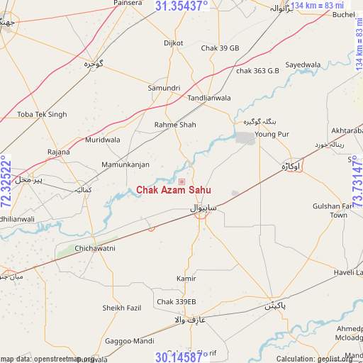
Chak Azam Sahu GPS coordinates[2]
30° 45' 7.272" North, 73° 1' 42.024" East
| Map corner | latitude | longitude |
|---|---|---|
| Upper-left | 31.35437°, | 72.32522° |
| Center: | 30.75202°, | 73.02834° |
| Lower-right: | 30.14587°, | 73.73147° |
| Map W x H: | 134.4×134.4 km | = 83.5×83.5mi |
| max Lat: | 36.32162° ⇑49.9% North |
| Chak Azam Sahu: | 30.75202° |
| min Lat: | ⇓50.1% South 24.14422° |
| min Long | Chak Azam Sahu | max Long |
| 61.74573° | 73.02834° | 75.63372° |
| W 72.9%⇐ | ⇒27.1% E |
Elevation
Elevation of Chak Azam Sahu is 170 m = 558 ft, and this is 175 m = 574 ft below average elevation for this country.
| Max E: |
2732 m = 8963 ft | 53.3% |
| Avg. | 345 m = 1132 ft | |
| Chak Azam Sahu | 170 m = 558 ft | |
Min E: |
3 m = 10 ft | 46.7% |
See also: Pakistan elevation on elevation.city.
Geographical zone
Chak Azam Sahu is located in North temperate zone (between Tropic of Cancer and the Arctic Circle). Distance of this Northern Tropic circle is 813.4 km =505.4 mi to South.| Distance of | km | miles | from Chak Azam Sahu |
|---|---|---|---|
| North Pole | 6587.8 | 4093.5 | to North |
| Arctic Circle | 3981.9 | 2474.2 | to North |
| Tropic Cancer | 813.4 | 505.4 | to South |
| Equator | 3419.3 | 2124.7 | to South |


Nearby cities:
15 places around Chak Azam Sahu: (largest is in red/bold)
• Arifwala
51.4 km =31.9 mi,  176°
176°
• Bahawalnagar
41.3 km =25.7 mi,  122°
122°
• Chak One Hundred Twenty Nine Left
35.9 km =22.3 mi, 177°
• Chak Thirty-one -Eleven Left
48.3 km =30 mi,  220°
220°
• Chichawatni
40.6 km =25.2 mi,  232°
232°
• Dijkot
51.8 km =32.2 mi,  356°
356°
• Gojra
55.1 km =34.2 mi,  323°
323°
• Kamalia
36.6 km =22.7 mi,  265°
265°
• Mamu Kanjan
23.5 km =14.6 mi,  291°
291°
• Mustafābād
47.6 km =29.6 mi,  70°
70°
• Okara
40.9 km =25.4 mi,  80°
80°
• Pir Mahal
56.8 km =35.3 mi, 271°
• Renala Khurd
56.2 km =34.9 mi, 75°
• Sahiwal
11.9 km =7.4 mi,  143°
143°
• Tandlianwala
32.9 km =20.4 mi,  17°
17°
Sources, notices
• [Note1] Compared only with cities in Pakistan existing in our database
• [Src1] Map data: © OpenStreetMap contributors (CC-BY-SA)
• [Src2] Other city data from geonames.org with taken over terms of usage.
• [Src3] Geographical zone / Annual Mean Temperature by Robert A. Rohde @ Wikipedia
